Area Overview for WV11 3NE
Photos of WV11 3NE

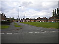
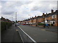
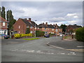
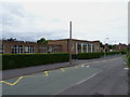
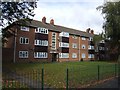
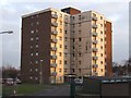
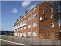
37 photos from this area
Area Information
Key information about the WV11 3NE including its size, population, and administrative classification.
- Area Type
- Postcode
- Area Size
- 1.6 hectares
- Population
- 1406
- Population Density
- 5512 people/km²
House Prices in WV11 3NE
46
Properties
£134,889
Average Sold Price
£31,000
Lowest Price
£228,000
Highest Price
Showing 46 properties
| Address | Type | Beds | Baths | Last Sale Price | Last Sale Date | |
|---|---|---|---|---|---|---|
| 99 Stubby Lane, Wolverhampton, WV11 3NE | Terraced | 3 | 1 | £220,000 | Jul 2023 | |
| 149 Stubby Lane, Wolverhampton, WV11 3NE | Retail | 3 | 1 | £185,000 | Sep 2022 | |
| 117 Stubby Lane, Wolverhampton, WV11 3NE | house | 3 | 1 | £200,000 | Aug 2022 | |
| 147 Stubby Lane, Wolverhampton, WV11 3NE | house | - | - | £185,000 | Apr 2022 | |
| 133 Stubby Lane, Wolverhampton, WV11 3NE | house | - | - | £166,000 | Nov 2021 | |
| 135 Stubby Lane, Wolverhampton, WV11 3NE | Semi-detached | 3 | - | £228,000 | Oct 2021 | |
| 89 Stubby Lane, Wolverhampton, WV11 3NE | house | - | - | £140,000 | Feb 2020 | |
| 111 Stubby Lane, Wolverhampton, WV11 3NE | house | - | - | £183,000 | Sep 2019 | |
| 107 Stubby Lane, Wolverhampton, WV11 3NE | house | - | - | £165,000 | Sep 2019 | |
| 119 Stubby Lane, Wolverhampton, WV11 3NE | Terraced | 4 | 2 | £190,000 | Jun 2018 |
Page 1 of 5
Energy Efficiency in WV11 3NE
Amenities
Schools
| Rank | School | Type | Entry gender | Ages |
|---|
Explore more schools in this area
Go to Schools tabDemographics
Household Size
One person
most common
Accommodation Type
Houses
most common
Tenure
51
majority
Ethnic Group
White
most common
Religion
N/A
most common
Household Composition
N/A
most common
Age
47
median
Adults (30-64 years)
most common
Household Deprivation
N/A
with no deprivation
NS-SEC
19
in Lower managerial occupations
Explore more demographic insights in this area
Go to Demographics tabPlanning
Planning Constraints
- Flood RiskPremium
- Ramsar Wetland SitesPremium
- Area of Outstanding Natural BeautyPremium
- Protected Nature ReservePremium
- Protected WoodlandPremium