Area Overview for WV11 2SG
Photos of WV11 2SG


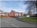
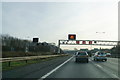
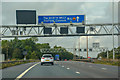
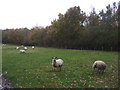


48 photos from this area
Area Information
Key information about the WV11 2SG including its size, population, and administrative classification.
- Area Type
- Postcode
- Area Size
- 2.0 hectares
- Population
- 1885
- Population Density
- 305 people/km²
House Prices in WV11 2SG
42
Properties
£395,850
Average Sold Price
£110,998
Lowest Price
£540,000
Highest Price
Showing 42 properties
| Address | Type | Beds | Baths | Last Sale Price | Last Sale Date | |
|---|---|---|---|---|---|---|
| 14 Elder Avenue, Essington, WV11 2SG | Detached | 5 | 3 | £540,000 | Aug 2025 | |
| 42 Elder Avenue, Essington, WV11 2SG | Detached | 3 | 2 | £350,000 | Jun 2025 | |
| 35 Elder Avenue, Essington, WV11 2SG | house | - | - | £237,500 | Mar 2024 | |
| 27 Elder Avenue, Essington, WV11 2SG | house | - | - | £334,995 | Jul 2023 | |
| 40 Elder Avenue, Essington, WV11 2SG | house | - | - | £319,995 | Jul 2023 | |
| 25 Elder Avenue, Essington, WV11 2SG | house | - | - | £334,995 | Jun 2023 | |
| 26 Elder Avenue, Essington, WV11 2SG | house | - | - | £249,995 | Jun 2023 | |
| 44 Elder Avenue, Essington, WV11 2SG | house | - | - | £409,995 | Jun 2023 | |
| 24 Elder Avenue, Essington, WV11 2SG | house | - | - | £394,995 | May 2023 | |
| 28 Elder Avenue, Essington, WV11 2SG | house | - | - | £110,998 | Mar 2023 |
Page 1 of 5
Energy Efficiency in WV11 2SG
Amenities
Schools
| Rank | School | Type | Entry gender | Ages |
|---|
Explore more schools in this area
Go to Schools tabDemographics
Household Size
Two person
most common
Accommodation Type
Houses
most common
Tenure
83
majority
Ethnic Group
White
most common
Religion
N/A
most common
Household Composition
N/A
most common
Age
47
median
Adults (30-64 years)
most common
Household Deprivation
N/A
with no deprivation
NS-SEC
36
in Lower managerial occupations
Explore more demographic insights in this area
Go to Demographics tabPlanning
Planning Constraints
- Flood RiskPremium
- Ramsar Wetland SitesPremium
- Area of Outstanding Natural BeautyPremium
- Protected Nature ReservePremium
- Protected WoodlandPremium