Area Overview for WV11 1YE
Photos of WV11 1YE
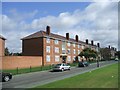
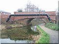
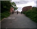
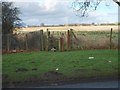
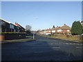

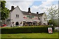


45 photos from this area
Area Information
Key information about the WV11 1YE including its size, population, and administrative classification.
- Area Type
- Postcode
- Area Size
- 1.6 hectares
- Population
- 1589
- Population Density
- 3775 people/km²
House Prices in WV11 1YE
33
Properties
£203,503
Average Sold Price
£74,000
Lowest Price
£410,000
Highest Price
Showing 33 properties
| Address | Type | Beds | Baths | Last Sale Price | Last Sale Date | |
|---|---|---|---|---|---|---|
| 467 Wood End Road, Wolverhampton, WV11 1YE | house | - | - | £299,000 | Feb 2025 | |
| 479 Wood End Road, Wolverhampton, WV11 1YE | Semi-detached | 3 | 1 | £280,000 | Oct 2023 | |
| 463A Wood End Road, Wolverhampton, WV11 1YE | Detached | 4 | 2 | £410,000 | May 2023 | |
| 473 Wood End Road, Wolverhampton, WV11 1YE | Semi-detached | 3 | 1 | £252,000 | Dec 2022 | |
| 463 Wood End Road, Wolverhampton, WV11 1YE | Semi-detached | 3 | 1 | £280,000 | Oct 2022 | |
| 423 Wood End Road, Wolverhampton, WV11 1YE | house | - | - | £341,000 | Jan 2021 | |
| 419 Wood End Road, Wolverhampton, WV11 1YE | house | - | - | £147,500 | Nov 2020 | |
| 461 Wood End Road, Wolverhampton, WV11 1YE | Semi-detached | 4 | 1 | £243,000 | Nov 2019 | |
| 421 Wood End Road, Wolverhampton, WV11 1YE | Semi-detached | 4 | - | £130,000 | Jan 2019 | |
| 477 Wood End Road, Wolverhampton, WV11 1YE | Semi-detached | 3 | 1 | £210,005 | Aug 2018 |
Page 1 of 4
Energy Efficiency in WV11 1YE
Amenities
Schools
| Rank | School | Type | Entry gender | Ages |
|---|
Explore more schools in this area
Go to Schools tabDemographics
Household Size
Family (3-5 people)
most common
Accommodation Type
Houses
most common
Tenure
71
majority
Ethnic Group
White
most common
Religion
N/A
most common
Household Composition
N/A
most common
Age
47
median
Adults (30-64 years)
most common
Household Deprivation
N/A
with no deprivation
NS-SEC
24
in Lower managerial occupations
Explore more demographic insights in this area
Go to Demographics tabPlanning
Planning Constraints
- Flood RiskPremium
- Ramsar Wetland SitesPremium
- Area of Outstanding Natural BeautyPremium
- Protected Nature ReservePremium
- Protected WoodlandPremium