Area Overview for WV10 9LU
Photos of WV10 9LU
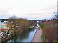
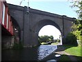
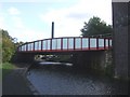
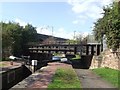
100 photos from this area
Area Information
Key information about the WV10 9LU including its size, population, and administrative classification.
- Area Type
- Postcode
- Area Size
- 8.0 hectares
- Population
- 1754
- Population Density
- 1507 people/km²
House Prices in WV10 9LU
68
Properties
£104,357
Average Sold Price
£30,000
Lowest Price
£242,000
Highest Price
Showing 68 properties
| Address | Type | Beds | Baths | Last Sale Price | Last Sale Date | |
|---|---|---|---|---|---|---|
| 43 Showell Road, Wolverhampton, WV10 9LU | Semi-detached | 3 | 1 | £192,000 | Oct 2024 | |
| 29 Showell Road, Wolverhampton, WV10 9LU | Semi-detached | 3 | 1 | £242,000 | Oct 2023 | |
| Caravan Site, Showell Road, Wolverhampton, WV10 9LU | Mobile Home | - | - | £75,000 | Dec 2017 | |
| 27 Showell Road, Wolverhampton, WV10 9LU | Semi-detached | 4 | 2 | £60,000 | Jan 2013 | |
| 25 Showell Road, Wolverhampton, WV10 9LU | house | 5 | 2 | £93,000 | May 2008 | |
| 33 Showell Road, Wolverhampton, WV10 9LU | Terraced | - | - | £38,500 | Jul 2001 | |
| 23 Showell Road, Wolverhampton, WV10 9LU | Semi-detached | - | - | £30,000 | Mar 1998 | |
| First Floor Flat, 21A Showell Road, Wolverhampton, WV10 9LU | undefined | - | - | - | - | |
| 19 Showell Road, Wolverhampton, WV10 9LU | shop | - | - | - | - | |
| 6, Caravan Site, Showell Road, Wolverhampton, WV10 9LU | Mobile Home | - | - | - | - |
Page 1 of 7
Energy Efficiency in WV10 9LU
Amenities
Schools
| Rank | School | Type | Entry gender | Ages |
|---|
Explore more schools in this area
Go to Schools tabDemographics
Household Size
Family (3-5 people)
most common
Accommodation Type
Houses
most common
Tenure
41
majority
Ethnic Group
asian_total
most common
Religion
N/A
most common
Household Composition
N/A
most common
Age
47
median
Adults (30-64 years)
most common
Household Deprivation
N/A
with no deprivation
NS-SEC
17
in Lower managerial occupations
Explore more demographic insights in this area
Go to Demographics tabPlanning
Planning Constraints
- Flood RiskPremium
- Ramsar Wetland SitesPremium
- Area of Outstanding Natural BeautyPremium
- Protected Nature ReservePremium
- Protected WoodlandPremium