Area Overview for WV10 9DX
Photos of WV10 9DX
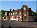
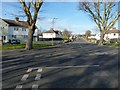
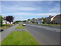
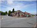
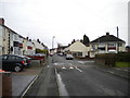
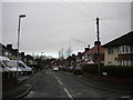
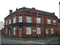
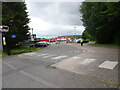


56 photos from this area
Area Information
Key information about the WV10 9DX including its size, population, and administrative classification.
- Area Type
- Postcode
- Area Size
- 2.6 hectares
- Population
- 1456
- Population Density
- 3467 people/km²
House Prices in WV10 9DX
25
Properties
£790,000
Average Sold Price
£790,000
Lowest Price
£790,000
Highest Price
Showing 25 properties
| Address | Type | Beds | Baths | Last Sale Price | Last Sale Date | |
|---|---|---|---|---|---|---|
| Plot 110, The Bluebird Park, Bridge Street, Heath Town, Wolverhampton, WV10 9DX | Detached | 3 | 2 | £790,000 | Sep 2011 | |
| Plot 109, The Bluebird Park, Bridge Street, Heath Town, Wolverhampton, WV10 9DX | Detached | 4 | 2 | - | - | |
| Plot 105, The Bluebird Park, Bridge Street, Heath Town, Wolverhampton, WV10 9DX | Detached | 3 | 2 | - | - | |
| Plot 113, The Bluebird Park, Bridge Street, Heath Town, Wolverhampton, WV10 9DX | Mobile Home | - | - | - | - | |
| Plot 103, The Bluebird Park, Bridge Street, Heath Town, Wolverhampton, WV10 9DX | Mobile Home | - | - | - | - | |
| A S Cabinets, 1A Bridge Street, Heath Town, Wolverhampton, WV10 9DX | general_industrial | - | - | - | - | |
| Plot 104, The Bluebird Park, Bridge Street, Heath Town, Wolverhampton, WV10 9DX | Mobile Home | - | - | - | - | |
| Plot 106, The Bluebird Park, Bridge Street, Heath Town, Wolverhampton, WV10 9DX | Mobile Home | - | - | - | - | |
| Plot 108, The Bluebird Park, Bridge Street, Heath Town, Wolverhampton, WV10 9DX | Mobile Home | - | - | - | - | |
| Plot 102, The Bluebird Park, Bridge Street, Heath Town, Wolverhampton, WV10 9DX | Mobile Home | - | - | - | - |
Page 1 of 3
Energy Efficiency in WV10 9DX
Amenities
Schools
| Rank | School | Type | Entry gender | Ages |
|---|
Explore more schools in this area
Go to Schools tabDemographics
Household Size
Family (3-5 people)
most common
Accommodation Type
Houses
most common
Tenure
28
majority
Ethnic Group
White
most common
Religion
N/A
most common
Household Composition
N/A
most common
Age
47
median
Adults (30-64 years)
most common
Household Deprivation
N/A
with no deprivation
NS-SEC
11
in Lower managerial occupations
Explore more demographic insights in this area
Go to Demographics tabPlanning
Planning Constraints
- Flood RiskPremium
- Ramsar Wetland SitesPremium
- Area of Outstanding Natural BeautyPremium
- Protected Nature ReservePremium
- Protected WoodlandPremium