Area Overview for WV10 8NY
Photos of WV10 8NY
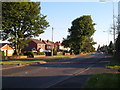

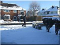
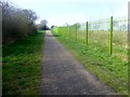
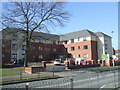
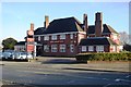
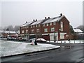
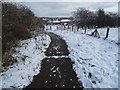

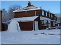

70 photos from this area
Area Information
Key information about the WV10 8NY including its size, population, and administrative classification.
- Area Type
- Postcode
- Area Size
- 12.1 hectares
- Population
- 1692
- Population Density
- 2903 people/km²
House Prices in WV10 8NY
64
Properties
£113,880
Average Sold Price
£28,000
Lowest Price
£220,000
Highest Price
Showing 64 properties
| Address | Type | Beds | Baths | Last Sale Price | Last Sale Date | |
|---|---|---|---|---|---|---|
| 2 Waterhead Drive, Wolverhampton, WV10 8NY | Semi-detached | 3 | 1 | £170,000 | Feb 2024 | |
| 67 Waterhead Drive, Wolverhampton, WV10 8NY | house | - | - | £220,000 | Aug 2022 | |
| 18 Waterhead Drive, Wolverhampton, WV10 8NY | Retail | 3 | 1 | £212,500 | Jul 2022 | |
| 16 Waterhead Drive, Wolverhampton, WV10 8NY | house | - | - | £170,000 | May 2022 | |
| 33 Waterhead Drive, Wolverhampton, WV10 8NY | house | - | - | £143,000 | Nov 2021 | |
| 34 Waterhead Drive, Wolverhampton, WV10 8NY | Terraced | 2 | - | £195,000 | Jun 2021 | |
| 4 Waterhead Drive, Wolverhampton, WV10 8NY | house | - | - | £150,000 | Dec 2020 | |
| 24 Waterhead Drive, Wolverhampton, WV10 8NY | Terraced | 2 | 1 | £128,000 | Oct 2020 | |
| 36 Waterhead Drive, Wolverhampton, WV10 8NY | house | 3 | 1 | £179,950 | May 2020 | |
| 73 Waterhead Drive, Wolverhampton, WV10 8NY | house | - | - | £125,000 | Sep 2019 |
Page 1 of 7
Energy Efficiency in WV10 8NY
Amenities
Schools
| Rank | School | Type | Entry gender | Ages |
|---|
Explore more schools in this area
Go to Schools tabDemographics
Household Size
Family (3-5 people)
most common
Accommodation Type
Houses
most common
Tenure
43
majority
Ethnic Group
White
most common
Religion
N/A
most common
Household Composition
N/A
most common
Age
47
median
Adults (30-64 years)
most common
Household Deprivation
N/A
with no deprivation
NS-SEC
14
in Lower managerial occupations
Explore more demographic insights in this area
Go to Demographics tabPlanning
Planning Constraints
- Flood RiskPremium
- Ramsar Wetland SitesPremium
- Area of Outstanding Natural BeautyPremium
- Protected Nature ReservePremium
- Protected WoodlandPremium