Area Overview for WV10 8BJ
Photos of WV10 8BJ
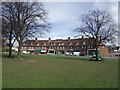


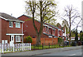
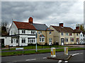
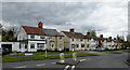
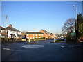
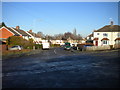
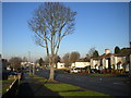


58 photos from this area
Area Information
Key information about the WV10 8BJ including its size, population, and administrative classification.
- Area Type
- Postcode
- Area Size
- 2.4 hectares
- Population
- 1507
- Population Density
- 3435 people/km²
House Prices in WV10 8BJ
14
Properties
£207,364
Average Sold Price
£19,500
Lowest Price
£1,250,000
Highest Price
Showing 14 properties
| Address | Type | Beds | Baths | Last Sale Price | Last Sale Date | |
|---|---|---|---|---|---|---|
| 69 Old Fallings Lane, Wolverhampton, WV10 8BJ | Semi-detached | 3 | 1 | £180,000 | Dec 2025 | |
| 63 Old Fallings Lane, Wolverhampton, WV10 8BJ | Semi-detached | 3 | 2 | £200,000 | Mar 2025 | |
| 65 Old Fallings Lane, Wolverhampton, WV10 8BJ | Semi-detached | 3 | 1 | £125,000 | May 2018 | |
| 99A Old Fallings Lane, Wolverhampton, WV10 8BJ | hospital_care_home | - | - | £1,250,000 | Apr 2017 | |
| 99 Old Fallings Lane, Wolverhampton, WV10 8BJ | Detached | 3 | - | £159,000 | Oct 2016 | |
| 73 Old Fallings Lane, Wolverhampton, WV10 8BJ | house | - | - | £68,000 | May 2012 | |
| 79 Old Fallings Lane, Wolverhampton, WV10 8BJ | Semi-detached | 3 | 1 | £92,000 | Aug 2006 | |
| 71 Old Fallings Lane, Wolverhampton, WV10 8BJ | Semi-detached | 3 | - | £105,500 | Sep 2004 | |
| 61 Old Fallings Lane, Wolverhampton, WV10 8BJ | Semi-detached | 3 | - | £44,000 | Feb 2001 | |
| 67 Old Fallings Lane, Wolverhampton, WV10 8BJ | Semi-detached | - | - | £19,500 | Jan 1999 |
Page 1 of 2
Energy Efficiency in WV10 8BJ
Amenities
Schools
| Rank | School | Type | Entry gender | Ages |
|---|
Explore more schools in this area
Go to Schools tabDemographics
Household Size
Family (3-5 people)
most common
Accommodation Type
Houses
most common
Tenure
42
majority
Ethnic Group
White
most common
Religion
N/A
most common
Household Composition
N/A
most common
Age
47
median
Adults (30-64 years)
most common
Household Deprivation
N/A
with no deprivation
NS-SEC
14
in Lower managerial occupations
Explore more demographic insights in this area
Go to Demographics tabPlanning
Planning Constraints
- Flood RiskPremium
- Ramsar Wetland SitesPremium
- Area of Outstanding Natural BeautyPremium
- Protected Nature ReservePremium
- Protected WoodlandPremium