Area Overview for WV10 7LU
Photos of WV10 7LU
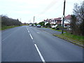


22 photos from this area
Area Information
Key information about the WV10 7LU including its size, population, and administrative classification.
- Area Type
- Postcode
- Area Size
- 57.0 hectares
- Population
- 1484
- Population Density
- 145 people/km²
House Prices in WV10 7LU
14
Properties
£177,500
Average Sold Price
£125,000
Lowest Price
£230,000
Highest Price
Showing 14 properties
| Address | Type | Beds | Baths | Last Sale Price | Last Sale Date | |
|---|---|---|---|---|---|---|
| Pine Dene, Wolverhampton Road, Laney Green, WV10 7LU | Detached | - | - | £125,000 | Aug 2022 | |
| Hollies Cottage, Wolverhampton Road, Laney Green, WV10 7LU | house | 3 | - | £230,000 | Oct 2013 | |
| Wheatsheaf Farm, Wolverhampton Road, Laney Green, WV10 7LU | Bungalow | 4 | - | - | - | |
| Zenas Pantry And Mobile, Hollies Poultry Farm, Wolverhampton Road, Laney Green, WV10 7LU | shop | - | - | - | - | |
| Longwaite, Wolverhampton Road, Laney Green, WV10 7LU | Detached | - | - | - | - | |
| Wheatsheaf Public House, Wolverhampton Road, Laney Green, WV10 7LU | Leisure | - | - | - | - | |
| The Old Appleyard Cottage, Wolverhampton Road, Laney Green, WV10 7LU | house | - | - | - | - | |
| No Bull Cafe, Snack Bar, Wolverhampton Road, Laney Green, WV10 7LU | Restaurant | - | - | - | - | |
| Managers Accomodation, Wheatsheaf Public House, Wolverhampton Road, Laney Green, WV10 7LU | Flat | - | - | - | - | |
| The Coach House, Wheatsheaf Farm, Wolverhampton Road, Laney Green, WV10 7LU | house | - | - | - | - |
Page 1 of 2
Energy Efficiency in WV10 7LU
Amenities
Schools
| Rank | School | Type | Entry gender | Ages |
|---|
Explore more schools in this area
Go to Schools tabDemographics
Household Size
Two person
most common
Accommodation Type
Houses
most common
Tenure
84
majority
Ethnic Group
White
most common
Religion
N/A
most common
Household Composition
N/A
most common
Age
47
median
Adults (30-64 years)
most common
Household Deprivation
N/A
with no deprivation
NS-SEC
34
in Lower managerial occupations
Explore more demographic insights in this area
Go to Demographics tabPlanning
Planning Constraints
- Flood RiskPremium
- Ramsar Wetland SitesPremium
- Area of Outstanding Natural BeautyPremium
- Protected Nature ReservePremium
- Protected WoodlandPremium