Area Overview for WV10 7JR
Photos of WV10 7JR
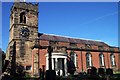
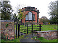

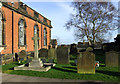
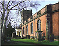
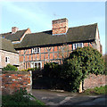
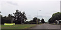
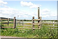
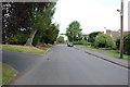
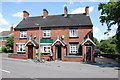
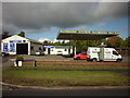
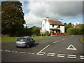
34 photos from this area
Area Information
Key information about the WV10 7JR including its size, population, and administrative classification.
- Area Type
- Postcode
- Area Size
- 5.3 hectares
- Population
- 1403
- Population Density
- 320 people/km²
House Prices in WV10 7JR
22
Properties
£331,300
Average Sold Price
£127,000
Lowest Price
£665,000
Highest Price
Showing 22 properties
| Address | Type | Beds | Baths | Last Sale Price | Last Sale Date | |
|---|---|---|---|---|---|---|
| 21 Church Road, Shareshill, WV10 7JR | house | - | - | £665,000 | Jun 2022 | |
| 27 Church Road, Shareshill, WV10 7JR | Terraced | 2 | 1 | £260,000 | Feb 2022 | |
| 17 Church Road, Shareshill, WV10 7JR | Detached | 4 | - | £462,000 | Oct 2020 | |
| 16 Church Road, Shareshill, WV10 7JR | Bungalow | 3 | 1 | £244,000 | Jun 2020 | |
| 19 Church Road, Shareshill, WV10 7JR | house | - | - | £445,000 | Nov 2019 | |
| 22 Church Road, Shareshill, WV10 7JR | house | - | - | £335,000 | Sep 2018 | |
| 15 Church Road, Shareshill, WV10 7JR | Detached | 4 | 2 | £310,000 | Mar 2017 | |
| 14 Church Road, Shareshill, WV10 7JR | Bungalow | - | - | £127,000 | Jun 2011 | |
| 11 Church Road, Shareshill, WV10 7JR | Detached | - | - | £250,000 | Dec 2009 | |
| 9 Church Road, Shareshill, WV10 7JR | house | - | - | £215,000 | Oct 2004 |
Page 1 of 3
Energy Efficiency in WV10 7JR
Amenities
Schools
| Rank | School | Type | Entry gender | Ages |
|---|
Explore more schools in this area
Go to Schools tabDemographics
Household Size
Two person
most common
Accommodation Type
Houses
most common
Tenure
86
majority
Ethnic Group
White
most common
Religion
N/A
most common
Household Composition
N/A
most common
Age
47
median
Adults (30-64 years)
most common
Household Deprivation
N/A
with no deprivation
NS-SEC
38
in Lower managerial occupations
Explore more demographic insights in this area
Go to Demographics tabPlanning
Planning Constraints
- Flood RiskPremium
- Ramsar Wetland SitesPremium
- Area of Outstanding Natural BeautyPremium
- Protected Nature ReservePremium
- Protected WoodlandPremium