Area Overview for WV10 6QW
Photos of WV10 6QW
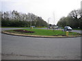
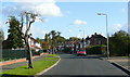
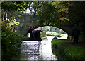


99 photos from this area
Area Information
Key information about the WV10 6QW including its size, population, and administrative classification.
- Area Type
- Postcode
- Area Size
- 1.6 hectares
- Population
- 1749
- Population Density
- 1873 people/km²
House Prices in WV10 6QW
48
Properties
£129,522
Average Sold Price
£40,000
Lowest Price
£202,000
Highest Price
Showing 48 properties
| Address | Type | Beds | Baths | Last Sale Price | Last Sale Date | |
|---|---|---|---|---|---|---|
| 58 Redhurst Drive, Wolverhampton, WV10 6QW | Semi-detached | 2 | 1 | £186,000 | Jun 2024 | |
| 44 Redhurst Drive, Wolverhampton, WV10 6QW | Terraced | 3 | 1 | £200,000 | Jul 2023 | |
| 74 Redhurst Drive, Wolverhampton, WV10 6QW | Terraced | 2 | 1 | £160,000 | Mar 2023 | |
| 66 Redhurst Drive, Wolverhampton, WV10 6QW | Semi-detached | 2 | 1 | £165,000 | Nov 2022 | |
| 68 Redhurst Drive, Wolverhampton, WV10 6QW | house | - | - | £202,000 | Nov 2022 | |
| 78 Redhurst Drive, Wolverhampton, WV10 6QW | Retail | 2 | 1 | £187,000 | May 2022 | |
| 28 Redhurst Drive, Wolverhampton, WV10 6QW | Terraced | 3 | 1 | £146,000 | Nov 2020 | |
| 14 Redhurst Drive, Wolverhampton, WV10 6QW | Terraced | 2 | 1 | £145,000 | Aug 2019 | |
| 30 Redhurst Drive, Wolverhampton, WV10 6QW | Terraced | 3 | 1 | £150,000 | May 2019 | |
| 72 Redhurst Drive, Wolverhampton, WV10 6QW | Terraced | 3 | 1 | £120,000 | Mar 2016 |
Page 1 of 5
Energy Efficiency in WV10 6QW
Amenities
Schools
| Rank | School | Type | Entry gender | Ages |
|---|
Explore more schools in this area
Go to Schools tabDemographics
Household Size
Family (3-5 people)
most common
Accommodation Type
Houses
most common
Tenure
53
majority
Ethnic Group
White
most common
Religion
N/A
most common
Household Composition
N/A
most common
Age
47
median
Adults (30-64 years)
most common
Household Deprivation
N/A
with no deprivation
NS-SEC
22
in Lower managerial occupations
Explore more demographic insights in this area
Go to Demographics tabPlanning
Planning Constraints
- Flood RiskPremium
- Ramsar Wetland SitesPremium
- Area of Outstanding Natural BeautyPremium
- Protected Nature ReservePremium
- Protected WoodlandPremium