Area Overview for WV10 6NW
Photos of WV10 6NW
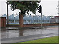
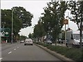
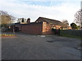
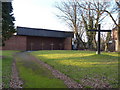


67 photos from this area
Area Information
Key information about the WV10 6NW including its size, population, and administrative classification.
- Area Type
- Postcode
- Area Size
- 4.6 hectares
- Population
- 1409
- Population Density
- 3890 people/km²
House Prices in WV10 6NW
37
Properties
£101,796
Average Sold Price
£41,000
Lowest Price
£178,500
Highest Price
Showing 37 properties
| Address | Type | Beds | Baths | Last Sale Price | Last Sale Date | |
|---|---|---|---|---|---|---|
| 660 Stafford Road, Wolverhampton, WV10 6NW | house | - | - | £178,500 | Jan 2024 | |
| 690 Stafford Road, Wolverhampton, WV10 6NW | Detached | 3 | 2 | £129,950 | Oct 2018 | |
| 692 Stafford Road, Wolverhampton, WV10 6NW | Semi-detached | 3 | 1 | £117,000 | Jun 2018 | |
| 654 Stafford Road, Wolverhampton, WV10 6NW | Semi-detached | 3 | 1 | £106,500 | Aug 2017 | |
| 672 Stafford Road, Wolverhampton, WV10 6NW | house | - | - | £137,000 | Sep 2016 | |
| 668 Stafford Road, Wolverhampton, WV10 6NW | Semi-detached | 3 | 1 | £111,999 | Mar 2016 | |
| 644 Stafford Road, Wolverhampton, WV10 6NW | Semi-detached | 3 | 2 | £130,000 | Feb 2016 | |
| 648 Stafford Road, Wolverhampton, WV10 6NW | Semi-detached | 3 | - | £90,000 | Sep 2013 | |
| 636A Stafford Road, Wolverhampton, WV10 6NW | house | - | - | £132,000 | Jun 2011 | |
| 694 Stafford Road, Wolverhampton, WV10 6NW | Semi-detached | - | - | £118,000 | Sep 2008 |
Page 1 of 4
Energy Efficiency in WV10 6NW
Amenities
Schools
| Rank | School | Type | Entry gender | Ages |
|---|
Explore more schools in this area
Go to Schools tabDemographics
Household Size
Two person
most common
Accommodation Type
Houses
most common
Tenure
74
majority
Ethnic Group
White
most common
Religion
N/A
most common
Household Composition
N/A
most common
Age
47
median
Adults (30-64 years)
most common
Household Deprivation
N/A
with no deprivation
NS-SEC
27
in Lower managerial occupations
Explore more demographic insights in this area
Go to Demographics tabPlanning
Planning Constraints
- Flood RiskPremium
- Ramsar Wetland SitesPremium
- Area of Outstanding Natural BeautyPremium
- Protected Nature ReservePremium
- Protected WoodlandPremium