Area Overview for WV10 6NE
Photos of WV10 6NE
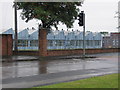
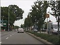
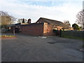
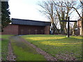

67 photos from this area
Area Information
Key information about the WV10 6NE including its size, population, and administrative classification.
- Area Type
- Postcode
- Area Size
- 1.2 hectares
- Population
- 1409
- Population Density
- 3890 people/km²
House Prices in WV10 6NE
33
Properties
£144,832
Average Sold Price
£40,000
Lowest Price
£268,000
Highest Price
Showing 33 properties
| Address | Type | Beds | Baths | Last Sale Price | Last Sale Date | |
|---|---|---|---|---|---|---|
| 9 Farmbrook Avenue, Wolverhampton, WV10 6NE | house | - | - | £239,950 | Oct 2025 | |
| 31 Farmbrook Avenue, Wolverhampton, WV10 6NE | Semi-detached | 3 | 1 | £268,000 | Aug 2023 | |
| 37 Farmbrook Avenue, Wolverhampton, WV10 6NE | house | - | - | £180,000 | Oct 2020 | |
| 22 Farmbrook Avenue, Wolverhampton, WV10 6NE | Detached | 3 | 1 | £187,000 | Sep 2018 | |
| 19 Farmbrook Avenue, Wolverhampton, WV10 6NE | Semi-detached | 3 | 1 | £155,000 | Mar 2018 | |
| 7 Farmbrook Avenue, Wolverhampton, WV10 6NE | Semi-detached | 3 | 1 | £170,000 | Apr 2017 | |
| 12 Farmbrook Avenue, Wolverhampton, WV10 6NE | Detached | 3 | 1 | £182,000 | Dec 2016 | |
| 10 Farmbrook Avenue, Wolverhampton, WV10 6NE | house | - | - | £150,000 | Dec 2015 | |
| 33 Farmbrook Avenue, Wolverhampton, WV10 6NE | house | 3 | 1 | £135,000 | Aug 2014 | |
| 23 Farmbrook Avenue, Wolverhampton, WV10 6NE | house | 3 | - | £114,950 | Jul 2010 |
Page 1 of 4
Energy Efficiency in WV10 6NE
Amenities
Schools
| Rank | School | Type | Entry gender | Ages |
|---|
Explore more schools in this area
Go to Schools tabDemographics
Household Size
Two person
most common
Accommodation Type
Houses
most common
Tenure
74
majority
Ethnic Group
White
most common
Religion
N/A
most common
Household Composition
N/A
most common
Age
47
median
Adults (30-64 years)
most common
Household Deprivation
N/A
with no deprivation
NS-SEC
27
in Lower managerial occupations
Explore more demographic insights in this area
Go to Demographics tabPlanning
Planning Constraints
- Flood RiskPremium
- Ramsar Wetland SitesPremium
- Area of Outstanding Natural BeautyPremium
- Protected Nature ReservePremium
- Protected WoodlandPremium