Area Overview for WV10 0SJ
Photos of WV10 0SJ
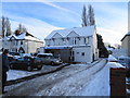
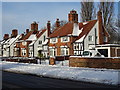
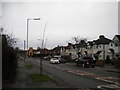
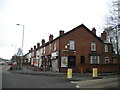
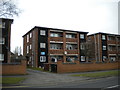
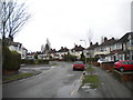
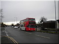

48 photos from this area
Area Information
Key information about the WV10 0SJ including its size, population, and administrative classification.
- Area Type
- Postcode
- Area Size
- 5182 m²
- Population
- 1585
- Population Density
- 5581 people/km²
House Prices in WV10 0SJ
14
Properties
£146,750
Average Sold Price
£57,000
Lowest Price
£242,500
Highest Price
Showing 14 properties
| Address | Type | Beds | Baths | Last Sale Price | Last Sale Date | |
|---|---|---|---|---|---|---|
| 34 Cadman Crescent, Wolverhampton, WV10 0SJ | Semi-detached | 3 | 1 | £225,000 | Jan 2023 | |
| 54 Cadman Crescent, Wolverhampton, WV10 0SJ | house | - | - | £205,000 | Mar 2021 | |
| 60 Cadman Crescent, Wolverhampton, WV10 0SJ | Detached | 5 | 2 | £242,500 | Apr 2018 | |
| 50 Cadman Crescent, Wolverhampton, WV10 0SJ | house | - | - | £136,000 | Sep 2015 | |
| 42 Cadman Crescent, Wolverhampton, WV10 0SJ | Semi-detached | 3 | - | £102,000 | Feb 2013 | |
| 36 Cadman Crescent, Wolverhampton, WV10 0SJ | house | 3 | 1 | £107,000 | Jul 2010 | |
| 48 Cadman Crescent, Wolverhampton, WV10 0SJ | Semi-detached | - | - | £99,500 | Aug 2009 | |
| 56 Cadman Crescent, Wolverhampton, WV10 0SJ | house | 3 | 1 | £57,000 | Oct 1999 | |
| 58 Cadman Crescent, Wolverhampton, WV10 0SJ | Semi-detached | 3 | 1 | - | - | |
| 40 Cadman Crescent, Wolverhampton, WV10 0SJ | Semi-detached | - | - | - | - |
Page 1 of 2
Energy Efficiency in WV10 0SJ
Amenities
Schools
| Rank | School | Type | Entry gender | Ages |
|---|
Explore more schools in this area
Go to Schools tabDemographics
Household Size
Family (3-5 people)
most common
Accommodation Type
Houses
most common
Tenure
74
majority
Ethnic Group
White
most common
Religion
N/A
most common
Household Composition
N/A
most common
Age
47
median
Adults (30-64 years)
most common
Household Deprivation
N/A
with no deprivation
NS-SEC
28
in Lower managerial occupations
Explore more demographic insights in this area
Go to Demographics tabPlanning
Planning Constraints
- Flood RiskPremium
- Ramsar Wetland SitesPremium
- Area of Outstanding Natural BeautyPremium
- Protected Nature ReservePremium
- Protected WoodlandPremium