Area Overview for WV10 0NA
Photos of WV10 0NA

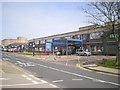
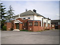
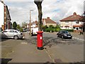
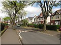
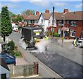
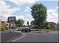
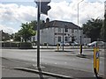
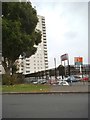

60 photos from this area
Area Information
Key information about the WV10 0NA including its size, population, and administrative classification.
- Area Type
- Postcode
- Area Size
- 8966 m²
- Population
- 1672
- Population Density
- 6707 people/km²
House Prices in WV10 0NA
25
Properties
£131,956
Average Sold Price
£33,750
Lowest Price
£243,000
Highest Price
Showing 25 properties
| Address | Type | Beds | Baths | Last Sale Price | Last Sale Date | |
|---|---|---|---|---|---|---|
| 170 Bushbury Road, Wolverhampton, WV10 0NA | Semi-detached | 4 | 2 | £243,000 | Aug 2025 | |
| 190 Bushbury Road, Wolverhampton, WV10 0NA | Terraced | 2 | 1 | £140,500 | Dec 2023 | |
| 172 Bushbury Road, Wolverhampton, WV10 0NA | Retail | 3 | 1 | £216,000 | Jun 2022 | |
| 174 Bushbury Road, Wolverhampton, WV10 0NA | Retail | 3 | 1 | £203,000 | Apr 2022 | |
| 166 Bushbury Road, Wolverhampton, WV10 0NA | Semi-detached | 3 | 1 | £192,000 | May 2020 | |
| 192 Bushbury Road, Wolverhampton, WV10 0NA | house | 2 | 1 | £100,000 | Aug 2018 | |
| 184 Bushbury Road, Wolverhampton, WV10 0NA | Terraced | 3 | 1 | £95,000 | Jun 2018 | |
| 180 Bushbury Road, Wolverhampton, WV10 0NA | Semi-detached | 3 | 1 | £101,000 | May 2017 | |
| 200 Bushbury Road, Wolverhampton, WV10 0NA | Detached | 4 | 1 | £210,000 | Apr 2016 | |
| 188 Bushbury Road, Wolverhampton, WV10 0NA | Terraced | 3 | - | £90,000 | Feb 2016 |
Page 1 of 3
Energy Efficiency in WV10 0NA
Amenities
Schools
| Rank | School | Type | Entry gender | Ages |
|---|
Explore more schools in this area
Go to Schools tabDemographics
Household Size
Family (3-5 people)
most common
Accommodation Type
Houses
most common
Tenure
46
majority
Ethnic Group
White
most common
Religion
N/A
most common
Household Composition
N/A
most common
Age
47
median
Adults (30-64 years)
most common
Household Deprivation
N/A
with no deprivation
NS-SEC
19
in Lower managerial occupations
Explore more demographic insights in this area
Go to Demographics tabPlanning
Planning Constraints
- Flood RiskPremium
- Ramsar Wetland SitesPremium
- Area of Outstanding Natural BeautyPremium
- Protected Nature ReservePremium
- Protected WoodlandPremium