Area Overview for WV10 0AF
Photos of WV10 0AF
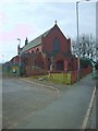
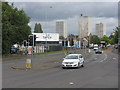
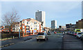
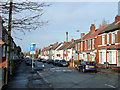
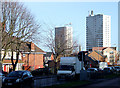
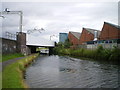
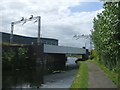
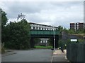
100 photos from this area
Area Information
Key information about the WV10 0AF including its size, population, and administrative classification.
- Area Type
- Postcode
- Area Size
- 1843 m²
- Population
- 1895
- Population Density
- 1720 people/km²
House Prices in WV10 0AF
8
Properties
£77,667
Average Sold Price
£60,000
Lowest Price
£93,000
Highest Price
Showing 8 properties
| Address | Type | Beds | Baths | Last Sale Price | Last Sale Date | |
|---|---|---|---|---|---|---|
| 159 Cannock Road, Springfield, Wolverhampton, WV10 0AF | Terraced | 3 | - | £93,000 | Nov 2020 | |
| 163 Cannock Road, Springfield, Wolverhampton, WV10 0AF | Terraced | 3 | 1 | £60,000 | Nov 2018 | |
| 161 Cannock Road, Springfield, Wolverhampton, WV10 0AF | Terraced | 2 | 1 | £80,000 | Oct 2005 | |
| 167 CANNOCK ROAD, Springfield, Wolverhampton, WV10 0AF | Detached | - | - | - | - | |
| Flat, 163 Cannock Road, Springfield, Wolverhampton, WV10 0AF | Flat | - | - | - | - | |
| 157 Cannock Road, Springfield, Wolverhampton, WV10 0AF | house | 3 | 1 | - | - | |
| 165 Cannock Road, Springfield, Wolverhampton, WV10 0AF | house | - | - | - | - | |
| Stop N Shop, 169 Cannock Road, Springfield, Wolverhampton, WV10 0AF | retail_financial | - | - | - | - |
Energy Efficiency in WV10 0AF
Amenities
Schools
| Rank | School | Type | Entry gender | Ages |
|---|
Explore more schools in this area
Go to Schools tabDemographics
Household Size
One person
most common
Accommodation Type
Houses
most common
Tenure
22
majority
Ethnic Group
White
most common
Religion
N/A
most common
Household Composition
N/A
most common
Age
22
median
Young Adults (15-29 years)
most common
Household Deprivation
N/A
with no deprivation
NS-SEC
14
in Lower managerial occupations
Explore more demographic insights in this area
Go to Demographics tabPlanning
Planning Constraints
- Flood RiskPremium
- Ramsar Wetland SitesPremium
- Area of Outstanding Natural BeautyPremium
- Protected Nature ReservePremium
- Protected WoodlandPremium