Area Overview for WV1 4AN
Photos of WV1 4AN
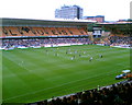
100 photos from this area
Area Information
Key information about the WV1 4AN including its size, population, and administrative classification.
- Area Type
- Postcode
- Area Size
- 1.6 hectares
- Population
- 1746
- Population Density
- 12218 people/km²
House Prices in WV1 4AN
94
Properties
£106,034
Average Sold Price
£28,000
Lowest Price
£397,000
Highest Price
Showing 94 properties
| Address | Type | Beds | Baths | Last Sale Price | Last Sale Date | |
|---|---|---|---|---|---|---|
| 32 Dunkley Street, Wolverhampton, WV1 4AN | house | 5 | 3 | £185,000 | Feb 2024 | |
| 33 Dunkley Street, Wolverhampton, WV1 4AN | house | - | - | £179,000 | Aug 2023 | |
| 31 Dunkley Street, Wolverhampton, WV1 4AN | house | - | - | £100,000 | Jun 2023 | |
| 34 Dunkley Street, Wolverhampton, WV1 4AN | Terraced | 4 | 1 | £165,000 | May 2023 | |
| 58 Dunkley Street, Wolverhampton, WV1 4AN | house | 3 | 1 | £141,000 | May 2023 | |
| 56 Dunkley Street, Wolverhampton, WV1 4AN | house | 4 | 1 | £146,000 | Oct 2022 | |
| 22 Dunkley Street, Wolverhampton, WV1 4AN | house | - | - | £118,000 | Jul 2021 | |
| 74 Dunkley Street, Wolverhampton, WV1 4AN | house | 5 | - | £182,000 | Sep 2020 | |
| 24 Dunkley Street, Wolverhampton, WV1 4AN | Terraced | 3 | 1 | £115,000 | Feb 2018 | |
| 26 Dunkley Street, Wolverhampton, WV1 4AN | Terraced | 3 | 1 | £110,000 | Nov 2017 |
Page 1 of 10
Energy Efficiency in WV1 4AN
Amenities
Schools
| Rank | School | Type | Entry gender | Ages |
|---|
Explore more schools in this area
Go to Schools tabDemographics
Household Size
One person
most common
Accommodation Type
Houses
most common
Tenure
22
majority
Ethnic Group
White
most common
Religion
N/A
most common
Household Composition
N/A
most common
Age
47
median
Adults (30-64 years)
most common
Household Deprivation
N/A
with no deprivation
NS-SEC
9
in Lower managerial occupations
Explore more demographic insights in this area
Go to Demographics tabPlanning
Planning Constraints
- Flood RiskPremium
- Ramsar Wetland SitesPremium
- Area of Outstanding Natural BeautyPremium
- Protected Nature ReservePremium
- Protected WoodlandPremium