Area Overview for WV1 2DN
Photos of WV1 2DN
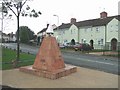
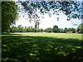


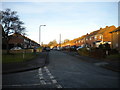

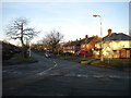
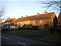
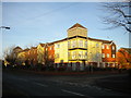
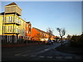


92 photos from this area
Area Information
Key information about the WV1 2DN including its size, population, and administrative classification.
- Area Type
- Postcode
- Area Size
- 2.7 hectares
- Population
- 1699
- Population Density
- 3684 people/km²
House Prices in WV1 2DN
61
Properties
£111,570
Average Sold Price
£37,000
Lowest Price
£240,000
Highest Price
Showing 61 properties
| Address | Type | Beds | Baths | Last Sale Price | Last Sale Date | |
|---|---|---|---|---|---|---|
| 5 East Park Way, Wolverhampton, WV1 2DN | Flat | 2 | 1 | £125,000 | Dec 2025 | |
| 5A East Park Way, Wolverhampton, WV1 2DN | Flat | - | - | £115,000 | Jun 2025 | |
| 37 East Park Way, Wolverhampton, WV1 2DN | Semi-detached | 3 | 1 | £240,000 | May 2025 | |
| 3A East Park Way, Wolverhampton, WV1 2DN | Flat | 2 | 1 | £115,000 | Apr 2024 | |
| 45 East Park Way, Wolverhampton, WV1 2DN | Terraced | 3 | 1 | £205,000 | Mar 2024 | |
| 66 East Park Way, Wolverhampton, WV1 2DN | Semi-detached | 3 | 1 | £180,000 | Mar 2023 | |
| 55 East Park Way, Wolverhampton, WV1 2DN | Retail | 3 | 1 | £215,000 | Jun 2022 | |
| 11 East Park Way, Wolverhampton, WV1 2DN | Flat | - | - | £107,500 | Jan 2022 | |
| 58 East Park Way, Wolverhampton, WV1 2DN | house | - | - | £150,000 | Nov 2021 | |
| 19 East Park Way, Wolverhampton, WV1 2DN | Terraced | 3 | 1 | £135,000 | Feb 2020 |
Page 1 of 7
Energy Efficiency in WV1 2DN
Amenities
Schools
| Rank | School | Type | Entry gender | Ages |
|---|
Explore more schools in this area
Go to Schools tabDemographics
Household Size
One person
most common
Accommodation Type
Houses
most common
Tenure
44
majority
Ethnic Group
White
most common
Religion
N/A
most common
Household Composition
N/A
most common
Age
47
median
Adults (30-64 years)
most common
Household Deprivation
N/A
with no deprivation
NS-SEC
18
in Lower managerial occupations
Explore more demographic insights in this area
Go to Demographics tabPlanning
Planning Constraints
- Flood RiskPremium
- Ramsar Wetland SitesPremium
- Area of Outstanding Natural BeautyPremium
- Protected Nature ReservePremium
- Protected WoodlandPremium