Area Overview for WS9 9LL
Photos of WS9 9LL

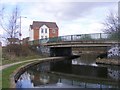
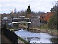
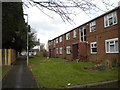
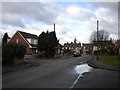
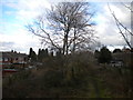
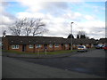
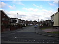
39 photos from this area
Area Information
Key information about the WS9 9LL including its size, population, and administrative classification.
- Area Type
- Postcode
- Area Size
- 1.3 hectares
- Population
- 1759
- Population Density
- 702 people/km²
House Prices in WS9 9LL
34
Properties
£157,136
Average Sold Price
£9,460
Lowest Price
£270,000
Highest Price
Showing 34 properties
| Address | Type | Beds | Baths | Last Sale Price | Last Sale Date | |
|---|---|---|---|---|---|---|
| 12 Prince Street, Walsall Wood, WS9 9LL | Semi-detached | 3 | 1 | £263,500 | Jul 2024 | |
| 25 Prince Street, Walsall Wood, WS9 9LL | house | - | - | £270,000 | Dec 2023 | |
| 23 Prince Street, Walsall Wood, WS9 9LL | house | - | - | £240,000 | Nov 2022 | |
| 27 Prince Street, Walsall Wood, WS9 9LL | Detached | 3 | 1 | £262,500 | Jun 2022 | |
| 11 Prince Street, Walsall Wood, WS9 9LL | Semi-detached | 3 | 1 | £230,000 | Nov 2021 | |
| 10 Prince Street, Walsall Wood, WS9 9LL | house | - | - | £175,000 | Sep 2021 | |
| 8 Prince Street, Walsall Wood, WS9 9LL | house | 3 | 1 | £190,000 | Aug 2017 | |
| 2 Prince Street, Walsall Wood, WS9 9LL | Bungalow | - | - | £9,460 | Jun 2017 | |
| 6 Prince Street, Walsall Wood, WS9 9LL | Semi-detached | 3 | 1 | £145,000 | Apr 2016 | |
| 18 Prince Street, Walsall Wood, WS9 9LL | Semi-detached | 3 | - | £127,000 | Dec 2014 |
Page 1 of 4
Energy Efficiency in WS9 9LL
Amenities
Schools
| Rank | School | Type | Entry gender | Ages |
|---|
Explore more schools in this area
Go to Schools tabDemographics
Household Size
Two person
most common
Accommodation Type
Houses
most common
Tenure
58
majority
Ethnic Group
White
most common
Religion
N/A
most common
Household Composition
N/A
most common
Age
47
median
Adults (30-64 years)
most common
Household Deprivation
N/A
with no deprivation
NS-SEC
24
in Lower managerial occupations
Explore more demographic insights in this area
Go to Demographics tabPlanning
Planning Constraints
- Flood RiskPremium
- Ramsar Wetland SitesPremium
- Area of Outstanding Natural BeautyPremium
- Protected Nature ReservePremium
- Protected WoodlandPremium