Area Overview for WS9 9JD
Photos of WS9 9JD


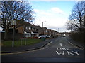
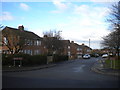
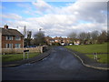
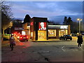

13 photos from this area
Area Information
Key information about the WS9 9JD including its size, population, and administrative classification.
- Area Type
- Postcode
- Area Size
- 2.6 hectares
- Population
- 1468
- Population Density
- 4297 people/km²
House Prices in WS9 9JD
60
Properties
£125,102
Average Sold Price
£34,000
Lowest Price
£260,000
Highest Price
Showing 60 properties
| Address | Type | Beds | Baths | Last Sale Price | Last Sale Date | |
|---|---|---|---|---|---|---|
| 12 Salters Road, Walsall Wood, WS9 9JD | Detached | 3 | 1 | £240,000 | Jan 2024 | |
| 13 Salters Road, Walsall Wood, WS9 9JD | Semi-detached | 2 | 1 | £143,000 | Nov 2023 | |
| 12A Salters Road, Walsall Wood, WS9 9JD | Detached | 3 | 1 | £260,000 | Jun 2023 | |
| 61 Salters Road, Walsall Wood, WS9 9JD | Semi-detached | 3 | 1 | £210,000 | Jan 2022 | |
| 24 Salters Road, Walsall Wood, WS9 9JD | house | - | - | £170,000 | Jan 2021 | |
| 59 Salters Road, Walsall Wood, WS9 9JD | house | - | - | £180,000 | Aug 2020 | |
| 65 Salters Road, Walsall Wood, WS9 9JD | house | - | - | £140,000 | Feb 2018 | |
| 35 Salters Road, Walsall Wood, WS9 9JD | Semi-detached | 3 | - | £144,950 | Jan 2018 | |
| 53 Salters Road, Walsall Wood, WS9 9JD | Semi-detached | 3 | 1 | £157,000 | Nov 2017 | |
| 67 Salters Road, Walsall Wood, WS9 9JD | Semi-detached | - | - | £150,000 | Aug 2017 |
Page 1 of 6
Energy Efficiency in WS9 9JD
Amenities
Schools
| Rank | School | Type | Entry gender | Ages |
|---|
Explore more schools in this area
Go to Schools tabDemographics
Household Size
Family (3-5 people)
most common
Accommodation Type
Houses
most common
Tenure
63
majority
Ethnic Group
White
most common
Religion
N/A
most common
Household Composition
N/A
most common
Age
47
median
Adults (30-64 years)
most common
Household Deprivation
N/A
with no deprivation
NS-SEC
25
in Lower managerial occupations
Explore more demographic insights in this area
Go to Demographics tabPlanning
Planning Constraints
- Flood RiskPremium
- Ramsar Wetland SitesPremium
- Area of Outstanding Natural BeautyPremium
- Protected Nature ReservePremium
- Protected WoodlandPremium