Area Overview for WS9 9DA
Photos of WS9 9DA
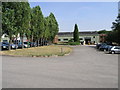
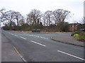
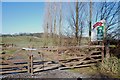
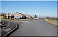
5 photos from this area
Area Information
Key information about the WS9 9DA including its size, population, and administrative classification.
- Area Type
- Postcode
- Area Size
- 38.8 hectares
- Population
- 1543
- Population Density
- 1341 people/km²
House Prices in WS9 9DA
17
Properties
£391,667
Average Sold Price
£130,000
Lowest Price
£515,000
Highest Price
Showing 17 properties
| Address | Type | Beds | Baths | Last Sale Price | Last Sale Date | |
|---|---|---|---|---|---|---|
| 15 Castlehill Road, Walsall Wood, WS9 9DA | house | - | - | £515,000 | Nov 2022 | |
| 55 Castlehill Road, Walsall Wood, WS9 9DA | house | - | - | £475,000 | Oct 2022 | |
| 57 Castlehill Road, Walsall Wood, WS9 9DA | house | - | - | £405,000 | Jun 2018 | |
| 9 Castlehill Road, Walsall Wood, WS9 9DA | house | - | - | £390,000 | Mar 2018 | |
| 170 Castlehill Road, Walsall Wood, WS9 9DA | Detached | - | - | £435,000 | Mar 2004 | |
| Castlebank Cottage, Castlehill Road, Walsall Wood, WS9 9DA | Detached | - | - | £130,000 | Apr 1997 | |
| 11 Castlehill Road, Walsall Wood, WS9 9DA | house | - | - | - | - | |
| 47 Castlehill Road, Walsall Wood, WS9 9DA | house | - | - | - | - | |
| 125 Castlehill Road, Walsall Wood, WS9 9DA | Detached | - | - | - | - | |
| 3 Castlehill Road, Walsall Wood, WS9 9DA | Semi-detached | - | - | - | - |
Page 1 of 2
Energy Efficiency in WS9 9DA
Amenities
Schools
| Rank | School | Type | Entry gender | Ages |
|---|
Explore more schools in this area
Go to Schools tabDemographics
Household Size
Family (3-5 people)
most common
Accommodation Type
Houses
most common
Tenure
91
majority
Ethnic Group
White
most common
Religion
N/A
most common
Household Composition
N/A
most common
Age
47
median
Adults (30-64 years)
most common
Household Deprivation
N/A
with no deprivation
NS-SEC
40
in Lower managerial occupations
Explore more demographic insights in this area
Go to Demographics tabPlanning
Planning Constraints
- Flood RiskPremium
- Ramsar Wetland SitesPremium
- Area of Outstanding Natural BeautyPremium
- Protected Nature ReservePremium
- Protected WoodlandPremium