Area Overview for WS9 9BH
Photos of WS9 9BH
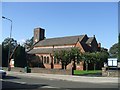
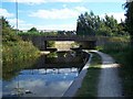
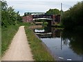
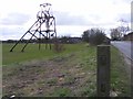
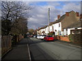
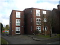
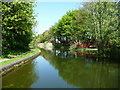
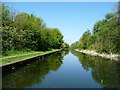


46 photos from this area
Area Information
Key information about the WS9 9BH including its size, population, and administrative classification.
- Area Type
- Postcode
- Area Size
- 6.7 hectares
- Population
- 1759
- Population Density
- 702 people/km²
House Prices in WS9 9BH
54
Properties
£143,313
Average Sold Price
£56,000
Lowest Price
£265,000
Highest Price
Showing 54 properties
| Address | Type | Beds | Baths | Last Sale Price | Last Sale Date | |
|---|---|---|---|---|---|---|
| 92 Coppice Road, Walsall Wood, WS9 9BH | Bungalow | 2 | 1 | £265,000 | Nov 2024 | |
| 67A Coppice Road, Walsall Wood, WS9 9BH | Semi-detached | 2 | - | £176,000 | Mar 2023 | |
| 71 Coppice Road, Walsall Wood, WS9 9BH | house | - | - | £140,000 | May 2022 | |
| 104 Coppice Road, Walsall Wood, WS9 9BH | Detached | 3 | 1 | £249,950 | Nov 2021 | |
| 108 Coppice Road, Walsall Wood, WS9 9BH | house | - | - | £200,000 | Nov 2020 | |
| 76 Coppice Road, Walsall Wood, WS9 9BH | Terraced | 2 | 1 | £123,000 | Aug 2019 | |
| 48 Coppice Road, Walsall Wood, WS9 9BH | house | 4 | 1 | £215,000 | Apr 2019 | |
| 50 Coppice Road, Walsall Wood, WS9 9BH | Terraced | 2 | 1 | £132,000 | Jan 2019 | |
| 78 Coppice Road, Walsall Wood, WS9 9BH | house | - | - | £133,000 | Jan 2019 | |
| 86 Coppice Road, Walsall Wood, WS9 9BH | Bungalow | 2 | 1 | £150,000 | Jun 2017 |
Page 1 of 6
Energy Efficiency in WS9 9BH
Amenities
Schools
| Rank | School | Type | Entry gender | Ages |
|---|
Explore more schools in this area
Go to Schools tabDemographics
Household Size
Two person
most common
Accommodation Type
Houses
most common
Tenure
58
majority
Ethnic Group
White
most common
Religion
N/A
most common
Household Composition
N/A
most common
Age
47
median
Adults (30-64 years)
most common
Household Deprivation
N/A
with no deprivation
NS-SEC
24
in Lower managerial occupations
Explore more demographic insights in this area
Go to Demographics tabPlanning
Planning Constraints
- Flood RiskPremium
- Ramsar Wetland SitesPremium
- Area of Outstanding Natural BeautyPremium
- Protected Nature ReservePremium
- Protected WoodlandPremium