Area Overview for WS9 8HQ
Photos of WS9 8HQ
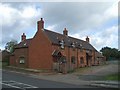
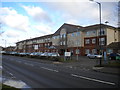
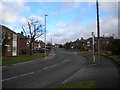
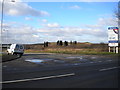
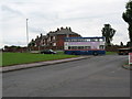
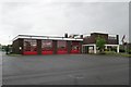
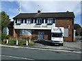
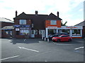
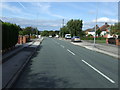
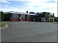
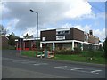
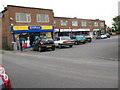
15 photos from this area
Area Information
Key information about the WS9 8HQ including its size, population, and administrative classification.
- Area Type
- Postcode
- Area Size
- 1.9 hectares
- Population
- 1504
- Population Density
- 2321 people/km²
House Prices in WS9 8HQ
61
Properties
£145,516
Average Sold Price
£40,000
Lowest Price
£255,000
Highest Price
Showing 61 properties
| Address | Type | Beds | Baths | Last Sale Price | Last Sale Date | |
|---|---|---|---|---|---|---|
| 259 Walsall Wood Road, Aldridge, WS9 8HQ | Terraced | 3 | 1 | £250,000 | Dec 2025 | |
| 263 Walsall Wood Road, Aldridge, WS9 8HQ | house | 2 | - | £255,000 | Jul 2025 | |
| 297 Walsall Wood Road, Aldridge, WS9 8HQ | house | - | - | £220,000 | Aug 2023 | |
| 279 Walsall Wood Road, Aldridge, WS9 8HQ | Terraced | 3 | 1 | £235,000 | Apr 2023 | |
| 271 Walsall Wood Road, Aldridge, WS9 8HQ | Terraced | 3 | 1 | £190,000 | Jun 2021 | |
| 269 Walsall Wood Road, Aldridge, WS9 8HQ | house | - | - | £192,000 | Nov 2019 | |
| 309 Walsall Wood Road, Aldridge, WS9 8HQ | Semi-detached | 3 | - | £140,000 | Sep 2019 | |
| 273 Walsall Wood Road, Aldridge, WS9 8HQ | house | - | - | £180,000 | Aug 2019 | |
| 311 Walsall Wood Road, Aldridge, WS9 8HQ | Terraced | 3 | - | £195,000 | Jun 2018 | |
| 317 Walsall Wood Road, Aldridge, WS9 8HQ | Semi-detached | 2 | 1 | £172,000 | Nov 2017 |
Page 1 of 7
Energy Efficiency in WS9 8HQ
Amenities
Schools
| Rank | School | Type | Entry gender | Ages |
|---|
Explore more schools in this area
Go to Schools tabDemographics
Household Size
Two person
most common
Accommodation Type
Houses
most common
Tenure
70
majority
Ethnic Group
White
most common
Religion
N/A
most common
Household Composition
N/A
most common
Age
47
median
Adults (30-64 years)
most common
Household Deprivation
N/A
with no deprivation
NS-SEC
27
in Lower managerial occupations
Explore more demographic insights in this area
Go to Demographics tabPlanning
Planning Constraints
- Flood RiskPremium
- Ramsar Wetland SitesPremium
- Area of Outstanding Natural BeautyPremium
- Protected Nature ReservePremium
- Protected WoodlandPremium