Area Overview for WS9 0HH
Photos of WS9 0HH
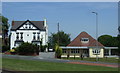
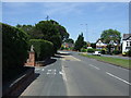
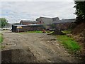
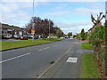
8 photos from this area
Area Information
Key information about the WS9 0HH including its size, population, and administrative classification.
- Area Type
- Postcode
- Area Size
- 2.0 hectares
- Population
- 1605
- Population Density
- 1241 people/km²
House Prices in WS9 0HH
46
Properties
£253,088
Average Sold Price
£57,000
Lowest Price
£590,000
Highest Price
Showing 46 properties
| Address | Type | Beds | Baths | Last Sale Price | Last Sale Date | |
|---|---|---|---|---|---|---|
| 231 Whetstone Lane, Aldridge, WS9 0HH | house | - | - | £590,000 | Aug 2024 | |
| 241 Whetstone Lane, Aldridge, WS9 0HH | house | 3 | 1 | £375,000 | Jul 2024 | |
| 211 Whetstone Lane, Aldridge, WS9 0HH | house | - | - | £330,000 | Mar 2023 | |
| 209 Whetstone Lane, Aldridge, WS9 0HH | house | - | - | £355,000 | Dec 2022 | |
| 258 Whetstone Lane, Aldridge, WS9 0HH | Semi-detached | 3 | 1 | £270,000 | Jun 2021 | |
| 224 Whetstone Lane, Aldridge, WS9 0HH | house | - | - | £310,000 | Jun 2021 | |
| 230 Whetstone Lane, Aldridge, WS9 0HH | Detached | 3 | 1 | £320,000 | Jun 2021 | |
| 226 Whetstone Lane, Aldridge, WS9 0HH | house | - | - | £280,000 | Mar 2021 | |
| 244 Whetstone Lane, Aldridge, WS9 0HH | Semi-detached | 3 | 1 | £275,000 | Sep 2020 | |
| 225 Whetstone Lane, Aldridge, WS9 0HH | Bungalow | - | - | £310,000 | Jul 2019 |
Page 1 of 5
Energy Efficiency in WS9 0HH
Amenities
Schools
| Rank | School | Type | Entry gender | Ages |
|---|
Explore more schools in this area
Go to Schools tabDemographics
Household Size
Family (3-5 people)
most common
Accommodation Type
Houses
most common
Tenure
94
majority
Ethnic Group
White
most common
Religion
N/A
most common
Household Composition
N/A
most common
Age
47
median
Adults (30-64 years)
most common
Household Deprivation
N/A
with no deprivation
NS-SEC
44
in Lower managerial occupations
Explore more demographic insights in this area
Go to Demographics tabPlanning
Planning Constraints
- Flood RiskPremium
- Ramsar Wetland SitesPremium
- Area of Outstanding Natural BeautyPremium
- Protected Nature ReservePremium
- Protected WoodlandPremium