Area Overview for WS8 6JS
Photos of WS8 6JS
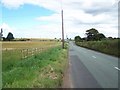
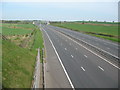
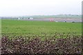
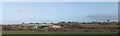


21 photos from this area
Area Information
Key information about the WS8 6JS including its size, population, and administrative classification.
- Area Type
- Postcode
- Area Size
- 18.6 hectares
- Population
- 1686
- Population Density
- 2613 people/km²
House Prices in WS8 6JS
39
Properties
£173,573
Average Sold Price
£55,000
Lowest Price
£390,000
Highest Price
Showing 39 properties
| Address | Type | Beds | Baths | Last Sale Price | Last Sale Date | |
|---|---|---|---|---|---|---|
| 60A Watling Street, New Town, WS8 6JS | Semi-detached | 3 | 1 | £170,000 | Sep 2024 | |
| 50 Watling Street, New Town, WS8 6JS | Semi-detached | 3 | 2 | £200,000 | Jun 2023 | |
| 62 Watling Street, New Town, WS8 6JS | Detached | 2 | 1 | £155,000 | Jul 2021 | |
| 34 Watling Street, New Town, WS8 6JS | Semi-detached | 3 | 1 | £156,000 | Mar 2021 | |
| 90 Watling Street, New Town, WS8 6JS | house | - | - | £390,000 | Feb 2021 | |
| 32 Watling Street, New Town, WS8 6JS | Semi-detached | 3 | 1 | £115,000 | Dec 2019 | |
| 72 Watling Street, New Town, WS8 6JS | Detached | 3 | 1 | £264,000 | Mar 2019 | |
| 60 Watling Street, New Town, WS8 6JS | house | - | - | £142,000 | Dec 2018 | |
| 64 Watling Street, New Town, WS8 6JS | house | - | - | £110,000 | Jul 2005 | |
| 88 Watling Street, New Town, WS8 6JS | Bungalow | - | - | £245,000 | Mar 2005 |
Page 1 of 4
Energy Efficiency in WS8 6JS
Amenities
Schools
| Rank | School | Type | Entry gender | Ages |
|---|
Explore more schools in this area
Go to Schools tabDemographics
Household Size
Two person
most common
Accommodation Type
Houses
most common
Tenure
75
majority
Ethnic Group
White
most common
Religion
N/A
most common
Household Composition
N/A
most common
Age
47
median
Adults (30-64 years)
most common
Household Deprivation
N/A
with no deprivation
NS-SEC
25
in Lower managerial occupations
Explore more demographic insights in this area
Go to Demographics tabPlanning
Planning Constraints
- Flood RiskPremium
- Ramsar Wetland SitesPremium
- Area of Outstanding Natural BeautyPremium
- Protected Nature ReservePremium
- Protected WoodlandPremium