Area Overview for WS8 6BG
Photos of WS8 6BG
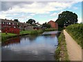
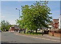
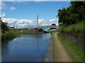
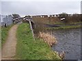
22 photos from this area
Area Information
Key information about the WS8 6BG including its size, population, and administrative classification.
- Area Type
- Postcode
- Area Size
- 1.6 hectares
- Population
- 1536
- Population Density
- 2765 people/km²
House Prices in WS8 6BG
41
Properties
£130,762
Average Sold Price
£32,000
Lowest Price
£216,000
Highest Price
Showing 41 properties
| Address | Type | Beds | Baths | Last Sale Price | Last Sale Date | |
|---|---|---|---|---|---|---|
| 16 Sadler Road, Brownhills, WS8 6BG | Terraced | 3 | 1 | £197,500 | Apr 2024 | |
| 14 Sadler Road, Brownhills, WS8 6BG | Semi-detached | 3 | 1 | £216,000 | Aug 2023 | |
| 22 Sadler Road, Brownhills, WS8 6BG | house | - | - | £186,000 | Dec 2022 | |
| 3 Sadler Road, Brownhills, WS8 6BG | Terraced | 3 | 1 | £170,000 | Mar 2022 | |
| 42 Sadler Road, Brownhills, WS8 6BG | house | - | - | £152,500 | Apr 2021 | |
| 11 Sadler Road, Brownhills, WS8 6BG | house | - | - | £152,000 | Mar 2020 | |
| 5 Sadler Road, Brownhills, WS8 6BG | house | - | - | £148,000 | Apr 2019 | |
| 56 Sadler Road, Brownhills, WS8 6BG | Terraced | 3 | 1 | £144,000 | Jul 2018 | |
| 40 Sadler Road, Brownhills, WS8 6BG | Terraced | 3 | 1 | £113,000 | Dec 2016 | |
| 38 Sadler Road, Brownhills, WS8 6BG | Terraced | - | - | £95,000 | Dec 2012 |
Page 1 of 5
Energy Efficiency in WS8 6BG
Amenities
Schools
| Rank | School | Type | Entry gender | Ages |
|---|
Explore more schools in this area
Go to Schools tabDemographics
Household Size
Family (3-5 people)
most common
Accommodation Type
Houses
most common
Tenure
63
majority
Ethnic Group
White
most common
Religion
N/A
most common
Household Composition
N/A
most common
Age
47
median
Adults (30-64 years)
most common
Household Deprivation
N/A
with no deprivation
NS-SEC
16
in Lower managerial occupations
Explore more demographic insights in this area
Go to Demographics tabPlanning
Planning Constraints
- Flood RiskPremium
- Ramsar Wetland SitesPremium
- Area of Outstanding Natural BeautyPremium
- Protected Nature ReservePremium
- Protected WoodlandPremium