Area Overview for WS7 9LA
Photos of WS7 9LA
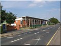
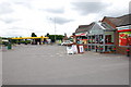
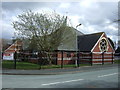
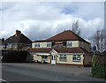
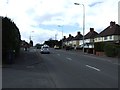
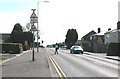
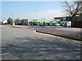
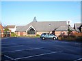
8 photos from this area
Area Information
Key information about the WS7 9LA including its size, population, and administrative classification.
- Area Type
- Postcode
- Area Size
- 2.8 hectares
- Population
- 1624
- Population Density
- 622 people/km²
House Prices in WS7 9LA
32
Properties
£337,028
Average Sold Price
£132,000
Lowest Price
£580,000
Highest Price
Showing 32 properties
| Address | Type | Beds | Baths | Last Sale Price | Last Sale Date | |
|---|---|---|---|---|---|---|
| 145 Hunslet Road, Burntwood, WS7 9LA | Detached | 4 | 2 | £475,000 | Nov 2025 | |
| 143 Hunslet Road, Burntwood, WS7 9LA | house | 4 | 2 | £480,000 | Dec 2024 | |
| 55 Hunslet Road, Burntwood, WS7 9LA | Detached | 4 | 3 | £442,000 | Sep 2024 | |
| 53 Hunslet Road, Burntwood, WS7 9LA | Detached | 4 | 2 | £340,000 | Feb 2020 | |
| 37 Hunslet Road, Burntwood, WS7 9LA | Detached | 4 | 2 | £333,000 | Aug 2019 | |
| 35 Hunslet Road, Burntwood, WS7 9LA | Detached | 4 | 2 | £315,000 | May 2019 | |
| 19 Hunslet Road, Burntwood, WS7 9LA | house | 4 | - | £580,000 | Mar 2019 | |
| 15 Hunslet Road, Burntwood, WS7 9LA | house | - | - | £550,000 | Feb 2019 | |
| 25 Hunslet Road, Burntwood, WS7 9LA | Detached | 5 | 2 | £448,500 | Sep 2018 | |
| 67 Hunslet Road, Burntwood, WS7 9LA | house | 4 | - | £445,000 | Dec 2016 |
Page 1 of 4
Energy Efficiency in WS7 9LA
Amenities
Schools
| Rank | School | Type | Entry gender | Ages |
|---|
Explore more schools in this area
Go to Schools tabDemographics
Household Size
Two person
most common
Accommodation Type
Houses
most common
Tenure
93
majority
Ethnic Group
White
most common
Religion
N/A
most common
Household Composition
N/A
most common
Age
47
median
Adults (30-64 years)
most common
Household Deprivation
N/A
with no deprivation
NS-SEC
47
in Lower managerial occupations
Explore more demographic insights in this area
Go to Demographics tabPlanning
Planning Constraints
- Flood RiskPremium
- Ramsar Wetland SitesPremium
- Area of Outstanding Natural BeautyPremium
- Protected Nature ReservePremium
- Protected WoodlandPremium