Area Overview for WS6 6DY
Photos of WS6 6DY

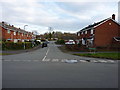
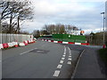
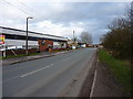
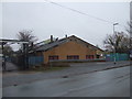

18 photos from this area
Area Information
Key information about the WS6 6DY including its size, population, and administrative classification.
- Area Type
- Postcode
- Area Size
- 2.5 hectares
- Population
- 1374
- Population Density
- 1477 people/km²
House Prices in WS6 6DY
27
Properties
£110,550
Average Sold Price
£57,000
Lowest Price
£152,500
Highest Price
Showing 27 properties
| Address | Type | Beds | Baths | Last Sale Price | Last Sale Date | |
|---|---|---|---|---|---|---|
| 46 Wardles Lane, Great Wyrley, WS6 6DY | house | 4 | - | £122,150 | Dec 2011 | |
| 52 Wardles Lane, Great Wyrley, WS6 6DY | house | - | - | £152,500 | Jan 2003 | |
| 42 Wardles Lane, Great Wyrley, WS6 6DY | Semi-detached | - | - | £57,000 | May 1998 | |
| 38 Wardles Lane, Great Wyrley, WS6 6DY | Detached | 3 | 1 | - | - | |
| Managers Accommodation, Bargain Booze, Wardles Lane, Great Wyrley, WS6 6DY | Flat | - | - | - | - | |
| 66 Wardles Lane, Great Wyrley, WS6 6DY | Flat | - | - | - | - | |
| 54 Wardles Lane, Great Wyrley, WS6 6DY | house | - | - | - | - | |
| 96 Wardles Lane, Great Wyrley, WS6 6DY | Flat | - | - | - | - | |
| 104 Wardles Lane, Great Wyrley, WS6 6DY | Flat | - | - | - | - | |
| 114 Wardles Lane, Great Wyrley, WS6 6DY | Flat | - | - | - | - |
Page 1 of 3
Energy Efficiency in WS6 6DY
Amenities
Schools
| Rank | School | Type | Entry gender | Ages |
|---|
Explore more schools in this area
Go to Schools tabDemographics
Household Size
Two person
most common
Accommodation Type
Houses
most common
Tenure
82
majority
Ethnic Group
White
most common
Religion
N/A
most common
Household Composition
N/A
most common
Age
47
median
Adults (30-64 years)
most common
Household Deprivation
N/A
with no deprivation
NS-SEC
26
in Lower managerial occupations
Explore more demographic insights in this area
Go to Demographics tabPlanning
Planning Constraints
- Flood RiskPremium
- Ramsar Wetland SitesPremium
- Area of Outstanding Natural BeautyPremium
- Protected Nature ReservePremium
- Protected WoodlandPremium