Area Overview for WS5 3PF
Photos of WS5 3PF
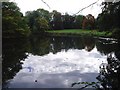
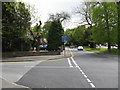
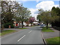
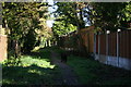
80 photos from this area
Area Information
Key information about the WS5 3PF including its size, population, and administrative classification.
- Area Type
- Postcode
- Area Size
- 2.9 hectares
- Population
- 2003
- Population Density
- 3013 people/km²
House Prices in WS5 3PF
30
Properties
£307,073
Average Sold Price
£104,000
Lowest Price
£575,000
Highest Price
Showing 30 properties
| Address | Type | Beds | Baths | Last Sale Price | Last Sale Date | |
|---|---|---|---|---|---|---|
| 23 Elizabeth Road, Walsall, WS5 3PF | Bungalow | 4 | 4 | £575,000 | Jun 2025 | |
| 6 Elizabeth Road, Walsall, WS5 3PF | house | - | - | £455,000 | Feb 2019 | |
| 7 Elizabeth Road, Walsall, WS5 3PF | Detached | 4 | - | £338,000 | Jan 2016 | |
| 22 Elizabeth Road, Walsall, WS5 3PF | Detached | 3 | - | £290,000 | Feb 2015 | |
| 16 Elizabeth Road, Walsall, WS5 3PF | Detached | 5 | 4 | £439,950 | Aug 2014 | |
| 19 Elizabeth Road, Walsall, WS5 3PF | Detached | 3 | - | £355,000 | Jun 2014 | |
| 17 Elizabeth Road, Walsall, WS5 3PF | house | - | - | £351,000 | Feb 2014 | |
| 12 Elizabeth Road, Walsall, WS5 3PF | Detached | 4 | - | £287,500 | Aug 2013 | |
| 4 Elizabeth Road, Walsall, WS5 3PF | Detached | 4 | - | £331,000 | Jul 2013 | |
| 10 Elizabeth Road, Walsall, WS5 3PF | house | - | - | £350,000 | May 2009 |
Page 1 of 3
Energy Efficiency in WS5 3PF
Amenities
Schools
| Rank | School | Type | Entry gender | Ages |
|---|
Explore more schools in this area
Go to Schools tabDemographics
Household Size
Family (3-5 people)
most common
Accommodation Type
Houses
most common
Tenure
88
majority
Ethnic Group
asian_total
most common
Religion
N/A
most common
Household Composition
N/A
most common
Age
47
median
Adults (30-64 years)
most common
Household Deprivation
N/A
with no deprivation
NS-SEC
42
in Lower managerial occupations
Explore more demographic insights in this area
Go to Demographics tabPlanning
Planning Constraints
- Flood RiskPremium
- Ramsar Wetland SitesPremium
- Area of Outstanding Natural BeautyPremium
- Protected Nature ReservePremium
- Protected WoodlandPremium