Area Overview for WS4 2ES
Photos of WS4 2ES
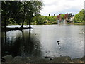
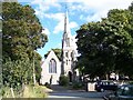
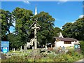
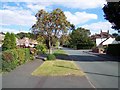
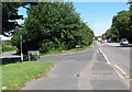
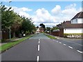
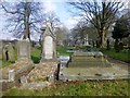
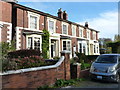
28 photos from this area
Area Information
Key information about the WS4 2ES including its size, population, and administrative classification.
- Area Type
- Postcode
- Area Size
- 1.4 hectares
- Population
- 1608
- Population Density
- 758 people/km²
House Prices in WS4 2ES
20
Properties
£251,357
Average Sold Price
£183,000
Lowest Price
£395,000
Highest Price
Showing 20 properties
| Address | Type | Beds | Baths | Last Sale Price | Last Sale Date | |
|---|---|---|---|---|---|---|
| 7 Cameron Road, Walsall, WS4 2ES | Bungalow | 2 | 1 | £200,000 | Feb 2025 | |
| 11 Cameron Road, Walsall, WS4 2ES | house | 4 | 1 | £395,000 | Jun 2024 | |
| 9 Cameron Road, Walsall, WS4 2ES | Bungalow | 3 | 1 | £330,000 | Feb 2023 | |
| 15 Cameron Road, Walsall, WS4 2ES | Retail | 3 | 1 | £325,000 | May 2022 | |
| 31 Cameron Road, Walsall, WS4 2ES | house | - | - | £290,000 | Oct 2020 | |
| 4 Cameron Road, Walsall, WS4 2ES | Bungalow | - | - | £195,000 | Feb 2017 | |
| 27 Cameron Road, Walsall, WS4 2ES | house | - | - | £210,000 | May 2016 | |
| 13 Cameron Road, Walsall, WS4 2ES | house | 4 | 1 | £250,000 | Dec 2014 | |
| 1 Cameron Road, Walsall, WS4 2ES | Bungalow | 2 | 1 | £275,000 | Aug 2014 | |
| 25 Cameron Road, Walsall, WS4 2ES | Semi-detached | 3 | - | £243,000 | Feb 2014 |
Page 1 of 2
Energy Efficiency in WS4 2ES
Amenities
Schools
| Rank | School | Type | Entry gender | Ages |
|---|
Explore more schools in this area
Go to Schools tabDemographics
Household Size
Two person
most common
Accommodation Type
Houses
most common
Tenure
89
majority
Ethnic Group
White
most common
Religion
N/A
most common
Household Composition
N/A
most common
Age
47
median
Adults (30-64 years)
most common
Household Deprivation
N/A
with no deprivation
NS-SEC
45
in Lower managerial occupations
Explore more demographic insights in this area
Go to Demographics tabPlanning
Planning Constraints
- Flood RiskPremium
- Ramsar Wetland SitesPremium
- Area of Outstanding Natural BeautyPremium
- Protected Nature ReservePremium
- Protected WoodlandPremium