Area Overview for WS4 1EB
Photos of WS4 1EB
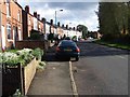
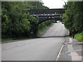
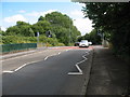
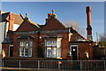
27 photos from this area
Area Information
Key information about the WS4 1EB including its size, population, and administrative classification.
- Area Type
- Postcode
- Area Size
- 14.0 hectares
- Population
- 1947
- Population Density
- 1947 people/km²
House Prices in WS4 1EB
31
Properties
£227,553
Average Sold Price
£70,000
Lowest Price
£600,000
Highest Price
Showing 31 properties
| Address | Type | Beds | Baths | Last Sale Price | Last Sale Date | |
|---|---|---|---|---|---|---|
| 295 Lichfield Road, Rushall, WS4 1EB | Semi-detached | 4 | 2 | £361,000 | Dec 2023 | |
| The Garnet, 269B Lichfield Road, Rushall, WS4 1EB | Detached | 5 | 2 | £440,000 | Jun 2023 | |
| The Sapphire, 269 Lichfield Road, Rushall, WS4 1EB | Land | 5 | 2 | £600,000 | Nov 2022 | |
| The Emerald, 269A Lichfield Road, Rushall, WS4 1EB | Detached | 5 | 2 | £360,000 | Oct 2020 | |
| 261 Lichfield Road, Rushall, WS4 1EB | Detached | 5 | 1 | £310,000 | Nov 2018 | |
| 279 Lichfield Road, Rushall, WS4 1EB | house | - | - | £245,000 | Sep 2018 | |
| 265 Lichfield Road, Rushall, WS4 1EB | house | 5 | 3 | £178,000 | Dec 2016 | |
| 289 Lichfield Road, Rushall, WS4 1EB | Semi-detached | 4 | 3 | £185,000 | Apr 2012 | |
| 293 Lichfield Road, Rushall, WS4 1EB | house | 6 | - | £240,000 | Nov 2009 | |
| 281 Lichfield Road, Rushall, WS4 1EB | house | - | - | £192,000 | Sep 2009 |
Page 1 of 4
Energy Efficiency in WS4 1EB
Amenities
Schools
| Rank | School | Type | Entry gender | Ages |
|---|
Explore more schools in this area
Go to Schools tabDemographics
Household Size
Two person
most common
Accommodation Type
Houses
most common
Tenure
65
majority
Ethnic Group
White
most common
Religion
N/A
most common
Household Composition
N/A
most common
Age
47
median
Adults (30-64 years)
most common
Household Deprivation
N/A
with no deprivation
NS-SEC
29
in Lower managerial occupations
Explore more demographic insights in this area
Go to Demographics tabPlanning
Planning Constraints
- Flood RiskPremium
- Ramsar Wetland SitesPremium
- Area of Outstanding Natural BeautyPremium
- Protected Nature ReservePremium
- Protected WoodlandPremium