Area Overview for WS3 4BN
Photos of WS3 4BN
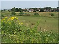
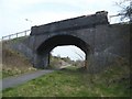
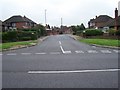
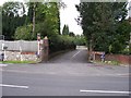
25 photos from this area
Area Information
Key information about the WS3 4BN including its size, population, and administrative classification.
- Area Type
- Postcode
- Area Size
- 9.7 hectares
- Population
- 1726
- Population Density
- 3117 people/km²
House Prices in WS3 4BN
60
Properties
£194,085
Average Sold Price
£40,500
Lowest Price
£550,000
Highest Price
Showing 60 properties
| Address | Type | Beds | Baths | Last Sale Price | Last Sale Date | |
|---|---|---|---|---|---|---|
| 90 Fordbrook Lane, Pelsall, WS3 4BN | house | - | - | £310,000 | Mar 2025 | |
| 110 Fordbrook Lane, Pelsall, WS3 4BN | Terraced | 3 | 1 | £205,000 | Feb 2025 | |
| 80 Fordbrook Lane, Pelsall, WS3 4BN | Semi-detached | 3 | 1 | £300,000 | Jan 2025 | |
| 20 Fordbrook Lane, Pelsall, WS3 4BN | Detached | 3 | 1 | £229,000 | Oct 2024 | |
| 52 Fordbrook Lane, Pelsall, WS3 4BN | Detached | 5 | 3 | £550,000 | Jun 2024 | |
| 102 Fordbrook Lane, Pelsall, WS3 4BN | Detached | 4 | 2 | £272,000 | Feb 2023 | |
| 76 Fordbrook Lane, Pelsall, WS3 4BN | Detached | 3 | 1 | £295,000 | Dec 2022 | |
| 60 Fordbrook Lane, Pelsall, WS3 4BN | house | - | - | £242,500 | Mar 2022 | |
| 58 Fordbrook Lane, Pelsall, WS3 4BN | house | - | - | £235,000 | Sep 2021 | |
| 88 Fordbrook Lane, Pelsall, WS3 4BN | house | - | - | £270,000 | Sep 2019 |
Page 1 of 6
Energy Efficiency in WS3 4BN
Amenities
Schools
| Rank | School | Type | Entry gender | Ages |
|---|
Explore more schools in this area
Go to Schools tabDemographics
Household Size
Two person
most common
Accommodation Type
Houses
most common
Tenure
75
majority
Ethnic Group
White
most common
Religion
N/A
most common
Household Composition
N/A
most common
Age
47
median
Adults (30-64 years)
most common
Household Deprivation
N/A
with no deprivation
NS-SEC
27
in Lower managerial occupations
Explore more demographic insights in this area
Go to Demographics tabPlanning
Planning Constraints
- Flood RiskPremium
- Ramsar Wetland SitesPremium
- Area of Outstanding Natural BeautyPremium
- Protected Nature ReservePremium
- Protected WoodlandPremium