Area Overview for WS3 3DJ
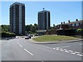
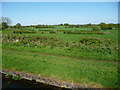
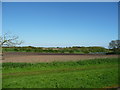
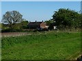
Photos of WS3 3DJ

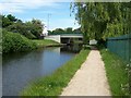
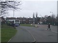
![Teeces [or Teece's] Bridge, from the south in WS3 3DJ](https://images.propbar.co.uk/images/geograph/57/90/5790887_120.jpg)
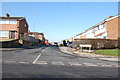
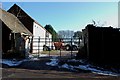
22 photos from this area
Area Information
Key information about the WS3 3DJ including its size, population, and administrative classification.
- Area Type
- Postcode
- Area Size
- 2.4 hectares
- Population
- 1680
- Population Density
- 3515 people/km²
House Prices in WS3 3DJ
51
Properties
£128,352
Average Sold Price
£32,500
Lowest Price
£205,000
Highest Price
Showing 51 properties
| Address | Type | Beds | Baths | Last Sale Price | Last Sale Date | |
|---|---|---|---|---|---|---|
| 5 Grenfell Road, Bloxwich, WS3 3DJ | Terraced | 3 | 1 | £170,000 | May 2024 | |
| 8 Grenfell Road, Bloxwich, WS3 3DJ | Semi-detached | 3 | 1 | £205,000 | Mar 2024 | |
| 25 Grenfell Road, Bloxwich, WS3 3DJ | Semi-detached | 2 | 1 | £185,000 | Jun 2023 | |
| 16 Grenfell Road, Bloxwich, WS3 3DJ | Semi-detached | 3 | 1 | £170,500 | Jan 2022 | |
| 21 Grenfell Road, Bloxwich, WS3 3DJ | house | - | - | £162,000 | Sep 2021 | |
| 53 Grenfell Road, Bloxwich, WS3 3DJ | Semi-detached | 3 | 1 | £198,000 | Aug 2021 | |
| 44 Grenfell Road, Bloxwich, WS3 3DJ | Terraced | 3 | 1 | £170,000 | Jun 2021 | |
| 43 Grenfell Road, Bloxwich, WS3 3DJ | Semi-detached | 3 | 1 | £165,000 | Jan 2021 | |
| 39 Grenfell Road, Bloxwich, WS3 3DJ | house | - | - | £125,000 | Dec 2019 | |
| 13 Grenfell Road, Bloxwich, WS3 3DJ | Terraced | 2 | 2 | £142,000 | May 2019 |
Page 1 of 6
Energy Efficiency in WS3 3DJ
Amenities
Schools
| Rank | School | Type | Entry gender | Ages |
|---|
Explore more schools in this area
Go to Schools tabDemographics
Household Size
Family (3-5 people)
most common
Accommodation Type
Houses
most common
Tenure
53
majority
Ethnic Group
White
most common
Religion
N/A
most common
Household Composition
N/A
most common
Age
47
median
Adults (30-64 years)
most common
Household Deprivation
N/A
with no deprivation
NS-SEC
17
in Lower managerial occupations
Explore more demographic insights in this area
Go to Demographics tabPlanning
Planning Constraints
- Flood RiskPremium
- Ramsar Wetland SitesPremium
- Area of Outstanding Natural BeautyPremium
- Protected Nature ReservePremium
- Protected WoodlandPremium