Area Overview for WS3 3AR
Photos of WS3 3AR
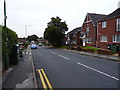
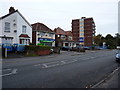
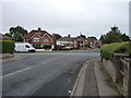
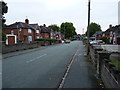
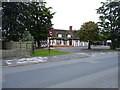
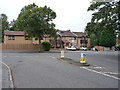
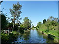
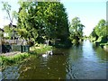
24 photos from this area
Area Information
Key information about the WS3 3AR including its size, population, and administrative classification.
- Area Type
- Postcode
- Area Size
- 1.4 hectares
- Population
- 1635
- Population Density
- 5405 people/km²
House Prices in WS3 3AR
38
Properties
£129,850
Average Sold Price
£66,000
Lowest Price
£195,200
Highest Price
Showing 38 properties
| Address | Type | Beds | Baths | Last Sale Price | Last Sale Date | |
|---|---|---|---|---|---|---|
| 94 Ryle Street, Bloxwich, WS3 3AR | Detached | 3 | 1 | £122,500 | May 2025 | |
| 60 Ryle Street, Bloxwich, WS3 3AR | Semi-detached | 3 | 1 | £160,500 | May 2024 | |
| 92 Ryle Street, Bloxwich, WS3 3AR | Semi-detached | 3 | 1 | £185,000 | Apr 2024 | |
| 70 Ryle Street, Bloxwich, WS3 3AR | Semi-detached | 2 | 1 | £164,000 | Apr 2023 | |
| 73 Ryle Street, Bloxwich, WS3 3AR | house | - | - | £195,200 | Oct 2022 | |
| 75 Ryle Street, Bloxwich, WS3 3AR | Semi-detached | 3 | 1 | £153,000 | Dec 2020 | |
| 55 Ryle Street, Bloxwich, WS3 3AR | Semi-detached | 3 | 1 | £90,000 | Oct 2020 | |
| 96 Ryle Street, Bloxwich, WS3 3AR | house | - | - | £135,000 | Jan 2020 | |
| 41 Ryle Street, Bloxwich, WS3 3AR | Terraced | 3 | 1 | £66,000 | Jun 2015 | |
| 65 Ryle Street, Bloxwich, WS3 3AR | house | 3 | 1 | £82,500 | Nov 2011 |
Page 1 of 4
Energy Efficiency in WS3 3AR
Amenities
Schools
| Rank | School | Type | Entry gender | Ages |
|---|
Explore more schools in this area
Go to Schools tabDemographics
Household Size
Family (3-5 people)
most common
Accommodation Type
Houses
most common
Tenure
43
majority
Ethnic Group
White
most common
Religion
N/A
most common
Household Composition
N/A
most common
Age
47
median
Adults (30-64 years)
most common
Household Deprivation
N/A
with no deprivation
NS-SEC
13
in Lower managerial occupations
Explore more demographic insights in this area
Go to Demographics tabPlanning
Planning Constraints
- Flood RiskPremium
- Ramsar Wetland SitesPremium
- Area of Outstanding Natural BeautyPremium
- Protected Nature ReservePremium
- Protected WoodlandPremium