Area Overview for WS3 2PX
Photos of WS3 2PX

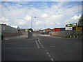
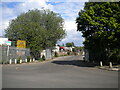
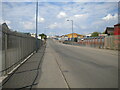
52 photos from this area
Area Information
Key information about the WS3 2PX including its size, population, and administrative classification.
- Area Type
- Postcode
- Area Size
- 1.1 hectares
- Population
- 1513
- Population Density
- 2897 people/km²
House Prices in WS3 2PX
38
Properties
£76,945
Average Sold Price
£34,950
Lowest Price
£117,000
Highest Price
Showing 38 properties
| Address | Type | Beds | Baths | Last Sale Price | Last Sale Date | |
|---|---|---|---|---|---|---|
| 21 Moorland Road, Bloxwich, WS3 2PX | Terraced | 3 | 1 | £112,000 | Apr 2025 | |
| 6A Moorland Road, Bloxwich, WS3 2PX | Terraced | 3 | 1 | £100,500 | Jul 2023 | |
| 9 Moorland Road, Bloxwich, WS3 2PX | house | - | - | £95,000 | Nov 2020 | |
| 35 Moorland Road, Bloxwich, WS3 2PX | Terraced | 2 | 1 | £117,000 | Oct 2019 | |
| 8A Moorland Road, Bloxwich, WS3 2PX | Terraced | 2 | 1 | £75,000 | Feb 2016 | |
| 17 Moorland Road, Bloxwich, WS3 2PX | Terraced | - | - | £98,000 | Oct 2007 | |
| 4A Moorland Road, Bloxwich, WS3 2PX | Bungalow | - | - | £60,000 | May 2003 | |
| 19 Moorland Road, Bloxwich, WS3 2PX | house | - | - | £39,000 | Dec 1999 | |
| 2 Moorland Road, Bloxwich, WS3 2PX | Detached | 3 | 1 | £38,000 | Aug 1998 | |
| 8 Moorland Road, Bloxwich, WS3 2PX | Terraced | - | - | £34,950 | Nov 1997 |
Page 1 of 4
Energy Efficiency in WS3 2PX
Amenities
Schools
| Rank | School | Type | Entry gender | Ages |
|---|
Explore more schools in this area
Go to Schools tabDemographics
Household Size
One person
most common
Accommodation Type
Houses
most common
Tenure
41
majority
Ethnic Group
White
most common
Religion
N/A
most common
Household Composition
N/A
most common
Age
47
median
Adults (30-64 years)
most common
Household Deprivation
N/A
with no deprivation
NS-SEC
13
in Lower managerial occupations
Explore more demographic insights in this area
Go to Demographics tabPlanning
Planning Constraints
- Flood RiskPremium
- Ramsar Wetland SitesPremium
- Area of Outstanding Natural BeautyPremium
- Protected Nature ReservePremium
- Protected WoodlandPremium