Area Overview for WS3 2PT
Photos of WS3 2PT

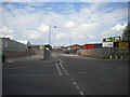
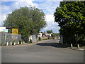
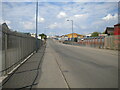
52 photos from this area
Area Information
Key information about the WS3 2PT including its size, population, and administrative classification.
- Area Type
- Postcode
- Area Size
- 2.3 hectares
- Population
- 1513
- Population Density
- 2897 people/km²
House Prices in WS3 2PT
70
Properties
£89,700
Average Sold Price
£13,600
Lowest Price
£144,000
Highest Price
Showing 70 properties
| Address | Type | Beds | Baths | Last Sale Price | Last Sale Date | |
|---|---|---|---|---|---|---|
| 33 Chase Road, Bloxwich, WS3 2PT | Semi-detached | 3 | 1 | £120,000 | Mar 2024 | |
| 10 Chase Road, Bloxwich, WS3 2PT | Semi-detached | 3 | 1 | £144,000 | Mar 2023 | |
| 9 Chase Road, Bloxwich, WS3 2PT | Semi-detached | 3 | 2 | £128,000 | Oct 2022 | |
| 78 Chase Road, Bloxwich, WS3 2PT | Terraced | - | - | £129,000 | Mar 2022 | |
| 47 Chase Road, Bloxwich, WS3 2PT | house | - | - | £127,500 | Oct 2021 | |
| 11 Chase Road, Bloxwich, WS3 2PT | house | - | - | £75,000 | Oct 2019 | |
| 90 Chase Road, Bloxwich, WS3 2PT | Semi-detached | 3 | 1 | £120,000 | Jul 2019 | |
| 23 Chase Road, Bloxwich, WS3 2PT | house | - | - | £95,000 | May 2016 | |
| 5 Chase Road, Bloxwich, WS3 2PT | house | 3 | - | £52,000 | Jul 2013 | |
| 4 Chase Road, Bloxwich, WS3 2PT | house | 3 | 1 | £61,000 | Oct 2009 |
Page 1 of 7
Energy Efficiency in WS3 2PT
Amenities
Schools
| Rank | School | Type | Entry gender | Ages |
|---|
Explore more schools in this area
Go to Schools tabDemographics
Household Size
One person
most common
Accommodation Type
Houses
most common
Tenure
41
majority
Ethnic Group
White
most common
Religion
N/A
most common
Household Composition
N/A
most common
Age
47
median
Adults (30-64 years)
most common
Household Deprivation
N/A
with no deprivation
NS-SEC
13
in Lower managerial occupations
Explore more demographic insights in this area
Go to Demographics tabPlanning
Planning Constraints
- Flood RiskPremium
- Ramsar Wetland SitesPremium
- Area of Outstanding Natural BeautyPremium
- Protected Nature ReservePremium
- Protected WoodlandPremium