Area Overview for WS3 2LS
Photos of WS3 2LS
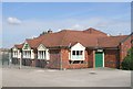
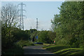
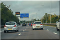
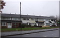
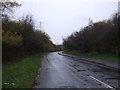
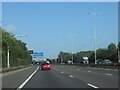
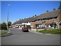
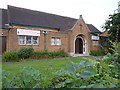
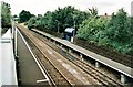
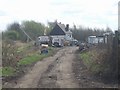
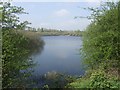
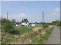
18 photos from this area
Area Information
Key information about the WS3 2LS including its size, population, and administrative classification.
- Area Type
- Postcode
- Area Size
- 6396 m²
- Population
- 1459
- Population Density
- 6708 people/km²
House Prices in WS3 2LS
18
Properties
£143,045
Average Sold Price
£50,000
Lowest Price
£295,000
Highest Price
Showing 18 properties
| Address | Type | Beds | Baths | Last Sale Price | Last Sale Date | |
|---|---|---|---|---|---|---|
| 257 Sneyd Lane, Bloxwich, WS3 2LS | Detached | 3 | 1 | £295,000 | Jul 2025 | |
| 271 Sneyd Lane, Bloxwich, WS3 2LS | Retail | 3 | 1 | £137,500 | Oct 2022 | |
| 283 Sneyd Lane, Bloxwich, WS3 2LS | house | - | - | £95,000 | Jun 2019 | |
| 279 Sneyd Lane, Bloxwich, WS3 2LS | Terraced | 3 | 1 | £86,500 | Aug 2015 | |
| 263 Sneyd Lane, Bloxwich, WS3 2LS | Detached | 3 | 1 | £150,000 | Apr 2011 | |
| 261 Sneyd Lane, Bloxwich, WS3 2LS | house | 5 | - | £220,000 | Oct 2010 | |
| 285 Sneyd Lane, Bloxwich, WS3 2LS | Terraced | 3 | 1 | £50,000 | Aug 2010 | |
| 267 Sneyd Lane, Bloxwich, WS3 2LS | Detached | - | - | £149,500 | May 2010 | |
| 265 Sneyd Lane, Bloxwich, WS3 2LS | Detached | 4 | - | £137,000 | Mar 2010 | |
| 277 Sneyd Lane, Bloxwich, WS3 2LS | Terraced | - | - | £84,000 | Dec 2006 |
Page 1 of 2
Energy Efficiency in WS3 2LS
Amenities
Schools
| Rank | School | Type | Entry gender | Ages |
|---|
Explore more schools in this area
Go to Schools tabDemographics
Household Size
Family (3-5 people)
most common
Accommodation Type
Houses
most common
Tenure
43
majority
Ethnic Group
White
most common
Religion
N/A
most common
Household Composition
N/A
most common
Age
47
median
Adults (30-64 years)
most common
Household Deprivation
N/A
with no deprivation
NS-SEC
15
in Lower managerial occupations
Explore more demographic insights in this area
Go to Demographics tabPlanning
Planning Constraints
- Flood RiskPremium
- Ramsar Wetland SitesPremium
- Area of Outstanding Natural BeautyPremium
- Protected Nature ReservePremium
- Protected WoodlandPremium