Area Overview for WS2 9DW
Photos of WS2 9DW
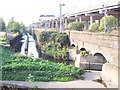
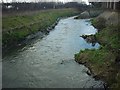
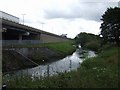
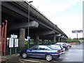


102 photos from this area
Area Information
Key information about the WS2 9DW including its size, population, and administrative classification.
- Area Type
- Postcode
- Area Size
- 7358 m²
- Population
- 1500
- Population Density
- 3622 people/km²
House Prices in WS2 9DW
31
Properties
£102,730
Average Sold Price
£24,600
Lowest Price
£195,000
Highest Price
Showing 31 properties
| Address | Type | Beds | Baths | Last Sale Price | Last Sale Date | |
|---|---|---|---|---|---|---|
| 1 Bryan Road, Walsall, WS2 9DW | house | 3 | 1 | £130,000 | Jul 2025 | |
| 19 Bryan Road, Walsall, WS2 9DW | Terraced | 3 | 1 | £184,000 | Feb 2025 | |
| 25 Bryan Road, Walsall, WS2 9DW | Semi-detached | 3 | 1 | £195,000 | Jan 2025 | |
| 9 Bryan Road, Walsall, WS2 9DW | house | - | - | £185,000 | Feb 2024 | |
| 18 Bryan Road, Walsall, WS2 9DW | house | 3 | - | £150,000 | Apr 2022 | |
| 30 Bryan Road, Walsall, WS2 9DW | Terraced | 2 | 1 | £125,000 | Mar 2021 | |
| 15 Bryan Road, Walsall, WS2 9DW | Terraced | 3 | - | £100,000 | Nov 2020 | |
| 23 Bryan Road, Walsall, WS2 9DW | Terraced | 3 | - | £78,000 | May 2019 | |
| 22 Bryan Road, Walsall, WS2 9DW | Terraced | 2 | 1 | £95,000 | Aug 2017 | |
| 26 Bryan Road, Walsall, WS2 9DW | Terraced | 2 | 1 | £83,000 | May 2013 |
Page 1 of 4
Energy Efficiency in WS2 9DW
Amenities
Schools
| Rank | School | Type | Entry gender | Ages |
|---|
Explore more schools in this area
Go to Schools tabDemographics
Household Size
Two person
most common
Accommodation Type
Houses
most common
Tenure
67
majority
Ethnic Group
White
most common
Religion
N/A
most common
Household Composition
N/A
most common
Age
47
median
Adults (30-64 years)
most common
Household Deprivation
N/A
with no deprivation
NS-SEC
20
in Lower managerial occupations
Explore more demographic insights in this area
Go to Demographics tabPlanning
Planning Constraints
- Flood RiskPremium
- Ramsar Wetland SitesPremium
- Area of Outstanding Natural BeautyPremium
- Protected Nature ReservePremium
- Protected WoodlandPremium