Area Overview for WS2 9BG
Photos of WS2 9BG

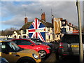
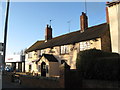
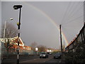
73 photos from this area
Area Information
Key information about the WS2 9BG including its size, population, and administrative classification.
- Area Type
- Postcode
- Area Size
- 1.8 hectares
- Population
- 1821
- Population Density
- 6815 people/km²
House Prices in WS2 9BG
43
Properties
£114,086
Average Sold Price
£50,500
Lowest Price
£200,000
Highest Price
Showing 43 properties
| Address | Type | Beds | Baths | Last Sale Price | Last Sale Date | |
|---|---|---|---|---|---|---|
| 149 Hough Road, Walsall, WS2 9BG | Semi-detached | 2 | 1 | £175,000 | Jul 2024 | |
| 191 Hough Road, Walsall, WS2 9BG | Semi-detached | 3 | - | £176,000 | Aug 2023 | |
| 187A Hough Road, Walsall, WS2 9BG | Semi-detached | 3 | 1 | £200,000 | Jun 2023 | |
| 173 Hough Road, Walsall, WS2 9BG | Terraced | 3 | 1 | £170,000 | Feb 2023 | |
| 139 Hough Road, Walsall, WS2 9BG | Terraced | 2 | 1 | £116,000 | Jun 2017 | |
| 185 Hough Road, Walsall, WS2 9BG | house | - | - | £105,000 | Feb 2017 | |
| 141 Hough Road, Walsall, WS2 9BG | Terraced | 2 | - | £98,000 | Dec 2015 | |
| 161 Hough Road, Walsall, WS2 9BG | house | 3 | - | £117,750 | Mar 2012 | |
| 209 Hough Road, Walsall, WS2 9BG | house | - | - | £60,000 | May 2011 | |
| 177 Hough Road, Walsall, WS2 9BG | house | 3 | 2 | £110,000 | Aug 2006 |
Page 1 of 5
Energy Efficiency in WS2 9BG
Amenities
Schools
| Rank | School | Type | Entry gender | Ages |
|---|
Explore more schools in this area
Go to Schools tabDemographics
Household Size
Family (3-5 people)
most common
Accommodation Type
Houses
most common
Tenure
40
majority
Ethnic Group
asian_total
most common
Religion
N/A
most common
Household Composition
N/A
most common
Age
47
median
Adults (30-64 years)
most common
Household Deprivation
N/A
with no deprivation
NS-SEC
11
in Lower managerial occupations
Explore more demographic insights in this area
Go to Demographics tabPlanning
Planning Constraints
- Flood RiskPremium
- Ramsar Wetland SitesPremium
- Area of Outstanding Natural BeautyPremium
- Protected Nature ReservePremium
- Protected WoodlandPremium