Area Overview for WS2 8PU
Photos of WS2 8PU
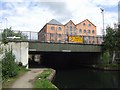
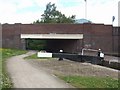
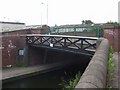
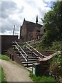

91 photos from this area
Area Information
Key information about the WS2 8PU including its size, population, and administrative classification.
- Area Type
- Postcode
- Area Size
- 4499 m²
- Population
- 1635
- Population Density
- 7698 people/km²
House Prices in WS2 8PU
27
Properties
£61,300
Average Sold Price
£15,000
Lowest Price
£115,000
Highest Price
Showing 27 properties
| Address | Type | Beds | Baths | Last Sale Price | Last Sale Date | |
|---|---|---|---|---|---|---|
| 87 Hollyhedge Lane, Walsall, WS2 8PU | Terraced | 2 | - | £115,000 | Aug 2024 | |
| 63 Hollyhedge Lane, Walsall, WS2 8PU | house | 3 | 1 | £105,000 | Feb 2024 | |
| 89 Hollyhedge Lane, Walsall, WS2 8PU | Terraced | - | - | £70,000 | Dec 2021 | |
| 79 Hollyhedge Lane, Walsall, WS2 8PU | Terraced | 3 | 1 | £61,000 | Aug 2017 | |
| 95 Hollyhedge Lane, Walsall, WS2 8PU | Terraced | - | - | £66,000 | May 2017 | |
| 77 Hollyhedge Lane, Walsall, WS2 8PU | house | - | - | £80,000 | Feb 2014 | |
| 65 Hollyhedge Lane, Walsall, WS2 8PU | house | 3 | - | £82,500 | Jul 2011 | |
| 57 Hollyhedge Lane, Walsall, WS2 8PU | Terraced | 3 | - | £59,000 | Nov 2009 | |
| 83 Hollyhedge Lane, Walsall, WS2 8PU | Terraced | - | - | £103,000 | Jan 2008 | |
| 61 Hollyhedge Lane, Walsall, WS2 8PU | Terraced | - | - | £65,000 | Dec 2004 |
Page 1 of 3
Energy Efficiency in WS2 8PU
Amenities
Schools
| Rank | School | Type | Entry gender | Ages |
|---|
Explore more schools in this area
Go to Schools tabDemographics
Household Size
Family (3-5 people)
most common
Accommodation Type
Houses
most common
Tenure
45
majority
Ethnic Group
asian_total
most common
Religion
N/A
most common
Household Composition
N/A
most common
Age
22
median
Adults (30-64 years)
most common
Household Deprivation
N/A
with no deprivation
NS-SEC
12
in Lower managerial occupations
Explore more demographic insights in this area
Go to Demographics tabPlanning
Planning Constraints
- Flood RiskPremium
- Ramsar Wetland SitesPremium
- Area of Outstanding Natural BeautyPremium
- Protected Nature ReservePremium
- Protected WoodlandPremium