Area Overview for WS2 7JP
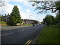
Photos of WS2 7JP
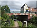

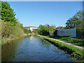
![Stokes [or Stoke's] Bridge, from the north in WS2 7JP](https://images.propbar.co.uk/images/geograph/57/92/5792730_120.jpg)
45 photos from this area
Area Information
Key information about the WS2 7JP including its size, population, and administrative classification.
- Area Type
- Postcode
- Area Size
- 9635 m²
- Population
- 1580
- Population Density
- 7208 people/km²
House Prices in WS2 7JP
34
Properties
£97,268
Average Sold Price
£70,000
Lowest Price
£135,000
Highest Price
Showing 34 properties
| Address | Type | Beds | Baths | Last Sale Price | Last Sale Date | |
|---|---|---|---|---|---|---|
| 119 Bloxwich Lane, Walsall, WS2 7JP | Terraced | 2 | 1 | £100,000 | Apr 2023 | |
| 101 Bloxwich Lane, Walsall, WS2 7JP | Semi-detached | 4 | - | £135,000 | Jan 2019 | |
| 139 Bloxwich Lane, Walsall, WS2 7JP | house | 3 | 2 | £126,000 | Nov 2015 | |
| 147 Bloxwich Lane, Walsall, WS2 7JP | Terraced | 5 | 2 | £122,000 | Sep 2015 | |
| 149 Bloxwich Lane, Walsall, WS2 7JP | house | 3 | - | £88,000 | Mar 2014 | |
| 129 Bloxwich Lane, Walsall, WS2 7JP | Terraced | 3 | - | £81,000 | May 2013 | |
| 143 Bloxwich Lane, Walsall, WS2 7JP | house | 3 | - | £83,500 | Aug 2011 | |
| 93 Bloxwich Lane, Walsall, WS2 7JP | house | 3 | - | £70,000 | Apr 2011 | |
| 141 Bloxwich Lane, Walsall, WS2 7JP | house | - | - | £78,000 | Mar 2010 | |
| 145 Bloxwich Lane, Walsall, WS2 7JP | Terraced | - | - | £99,500 | Jul 2006 |
Page 1 of 4
Energy Efficiency in WS2 7JP
Amenities
Schools
| Rank | School | Type | Entry gender | Ages |
|---|
Explore more schools in this area
Go to Schools tabDemographics
Household Size
Family (3-5 people)
most common
Accommodation Type
Houses
most common
Tenure
36
majority
Ethnic Group
White
most common
Religion
N/A
most common
Household Composition
N/A
most common
Age
47
median
Adults (30-64 years)
most common
Household Deprivation
N/A
with no deprivation
NS-SEC
12
in Lower managerial occupations
Explore more demographic insights in this area
Go to Demographics tabPlanning
Planning Constraints
- Flood RiskPremium
- Ramsar Wetland SitesPremium
- Area of Outstanding Natural BeautyPremium
- Protected Nature ReservePremium
- Protected WoodlandPremium