Area Overview for WS2 7HR
Photos of WS2 7HR
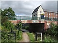

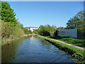
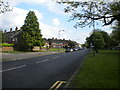
![Stokes [or Stoke's] Bridge, from the north in WS2 7HR](https://images.propbar.co.uk/images/geograph/57/92/5792730_120.jpg)
45 photos from this area
Area Information
Key information about the WS2 7HR including its size, population, and administrative classification.
- Area Type
- Postcode
- Area Size
- 1.6 hectares
- Population
- 1891
- Population Density
- 4986 people/km²
House Prices in WS2 7HR
40
Properties
£110,945
Average Sold Price
£37,500
Lowest Price
£190,000
Highest Price
Showing 40 properties
| Address | Type | Beds | Baths | Last Sale Price | Last Sale Date | |
|---|---|---|---|---|---|---|
| 76 Cavendish Road, Walsall, WS2 7HR | Terraced | 2 | 1 | £161,000 | Jan 2024 | |
| 82 Cavendish Road, Walsall, WS2 7HR | house | - | - | £112,000 | Mar 2021 | |
| 84 Cavendish Road, Walsall, WS2 7HR | house | - | - | £122,500 | Jan 2021 | |
| 86 Cavendish Road, Walsall, WS2 7HR | Terraced | 2 | 1 | £190,000 | Mar 2019 | |
| 90 Cavendish Road, Walsall, WS2 7HR | Terraced | 3 | 1 | £116,000 | Nov 2018 | |
| 70 Cavendish Road, Walsall, WS2 7HR | Terraced | 2 | 1 | £95,500 | Apr 2018 | |
| 74 Cavendish Road, Walsall, WS2 7HR | Terraced | 3 | - | £85,000 | Jul 2012 | |
| 96 Cavendish Road, Walsall, WS2 7HR | house | - | - | £99,950 | Dec 2006 | |
| 94 Cavendish Road, Walsall, WS2 7HR | house | - | - | £90,000 | Dec 2006 | |
| 72 Cavendish Road, Walsall, WS2 7HR | Terraced | - | - | £37,500 | Nov 1999 |
Page 1 of 4
Energy Efficiency in WS2 7HR
Amenities
Schools
| Rank | School | Type | Entry gender | Ages |
|---|
Explore more schools in this area
Go to Schools tabDemographics
Household Size
Family (3-5 people)
most common
Accommodation Type
Houses
most common
Tenure
31
majority
Ethnic Group
White
most common
Religion
N/A
most common
Household Composition
N/A
most common
Age
47
median
Adults (30-64 years)
most common
Household Deprivation
N/A
with no deprivation
NS-SEC
13
in Lower managerial occupations
Explore more demographic insights in this area
Go to Demographics tabPlanning
Planning Constraints
- Flood RiskPremium
- Ramsar Wetland SitesPremium
- Area of Outstanding Natural BeautyPremium
- Protected Nature ReservePremium
- Protected WoodlandPremium