Area Overview for WS2 7DQ
Photos of WS2 7DQ
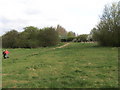


![Edwards [or Edwards'] Bridge, from the south in WS2 7DQ](https://images.propbar.co.uk/images/geograph/57/92/5792768_120.jpg)


47 photos from this area
Area Information
Key information about the WS2 7DQ including its size, population, and administrative classification.
- Area Type
- Postcode
- Area Size
- 19.7 hectares
- Population
- 1505
- Population Density
- 1923 people/km²
House Prices in WS2 7DQ
7
Properties
-
Average Sold Price
-
Lowest Price
-
Highest Price
Showing 7 properties
| Address | Type | Beds | Baths | Last Sale Price | Last Sale Date | |
|---|---|---|---|---|---|---|
| The Birches Printers Lts, Spectrum House, Leamore Lane, Walsall, WS2 7DQ | Industrial | - | - | - | - | |
| National Car Hub, Leamore Lane, Walsall, WS2 7DQ | warehouse | - | - | - | - | |
| Mary Elliot School, Leamore Lane, Walsall, WS2 7DQ | commercial | - | - | - | - | |
| Former F And S Furniture, Leamore Lane, Walsall, WS2 7DQ | warehouse | - | - | - | - | |
| Black Country Windows Ltd, Leamore Lane, Walsall, WS2 7DQ | Industrial | - | - | - | - | |
| Tr Fitness Studio And Gym, Leamore Lane, Walsall, WS2 7DQ | Leisure | - | - | - | - | |
| Spectrum Print Direct Ltd, Spectrum House, Leamore Lane, Walsall, WS2 7DQ | office_workshop | - | - | - | - |
Energy Efficiency in WS2 7DQ
Amenities
Schools
| Rank | School | Type | Entry gender | Ages |
|---|
Explore more schools in this area
Go to Schools tabDemographics
Household Size
Family (3-5 people)
most common
Accommodation Type
Houses
most common
Tenure
32
majority
Ethnic Group
White
most common
Religion
N/A
most common
Household Composition
N/A
most common
Age
47
median
Adults (30-64 years)
most common
Household Deprivation
N/A
with no deprivation
NS-SEC
11
in Lower managerial occupations
Explore more demographic insights in this area
Go to Demographics tabPlanning
Planning Constraints
- Flood RiskPremium
- Ramsar Wetland SitesPremium
- Area of Outstanding Natural BeautyPremium
- Protected Nature ReservePremium
- Protected WoodlandPremium