Area Overview for WS2 7BB
Photos of WS2 7BB
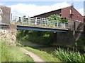
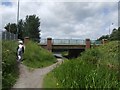
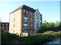

![Stubbs [or Stubbs'] Bridge, from the north in WS2 7BB](https://images.propbar.co.uk/images/geograph/57/92/5792719_120.jpg)
51 photos from this area
Area Information
Key information about the WS2 7BB including its size, population, and administrative classification.
- Area Type
- Postcode
- Area Size
- 1.1 hectares
- Population
- 2707
- Population Density
- 6429 people/km²
House Prices in WS2 7BB
50
Properties
£74,293
Average Sold Price
£22,000
Lowest Price
£120,000
Highest Price
Showing 50 properties
| Address | Type | Beds | Baths | Last Sale Price | Last Sale Date | |
|---|---|---|---|---|---|---|
| 259 Bloxwich Road, Walsall, WS2 7BB | Detached | 2 | 2 | £105,500 | Oct 2025 | |
| 233 Bloxwich Road, Walsall, WS2 7BB | Terraced | 2 | 1 | £83,000 | May 2021 | |
| 183 Bloxwich Road, Walsall, WS2 7BB | house | - | - | £120,000 | Jun 2020 | |
| 215 Bloxwich Road, Walsall, WS2 7BB | house | - | - | £110,000 | Oct 2019 | |
| 245 Bloxwich Road, Walsall, WS2 7BB | Flat | - | - | £60,000 | Oct 2019 | |
| 239 Bloxwich Road, Walsall, WS2 7BB | Terraced | 1 | 1 | £103,000 | Sep 2018 | |
| 217 Bloxwich Road, Walsall, WS2 7BB | Terraced | 2 | 1 | £89,000 | Jan 2018 | |
| 203 Bloxwich Road, Walsall, WS2 7BB | house | - | - | £82,000 | Aug 2015 | |
| 191 Bloxwich Road, Walsall, WS2 7BB | house | - | - | £85,000 | Nov 2014 | |
| 201 Bloxwich Road, Walsall, WS2 7BB | Terraced | 3 | - | £84,000 | Nov 2012 |
Page 1 of 5
Energy Efficiency in WS2 7BB
Amenities
Schools
| Rank | School | Type | Entry gender | Ages |
|---|
Explore more schools in this area
Go to Schools tabDemographics
Household Size
Family (3-5 people)
most common
Accommodation Type
Houses
most common
Tenure
53
majority
Ethnic Group
White
most common
Religion
N/A
most common
Household Composition
N/A
most common
Age
47
median
Adults (30-64 years)
most common
Household Deprivation
N/A
with no deprivation
NS-SEC
18
in Lower managerial occupations
Explore more demographic insights in this area
Go to Demographics tabPlanning
Planning Constraints
- Flood RiskPremium
- Ramsar Wetland SitesPremium
- Area of Outstanding Natural BeautyPremium
- Protected Nature ReservePremium
- Protected WoodlandPremium