Area Overview for WS2 0LR
Photos of WS2 0LR
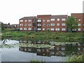

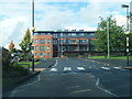
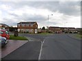
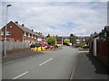
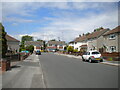
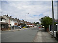
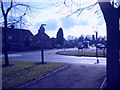
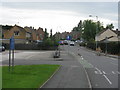
26 photos from this area
Area Information
Key information about the WS2 0LR including its size, population, and administrative classification.
- Area Type
- Postcode
- Area Size
- 3.0 hectares
- Population
- 1317
- Population Density
- 6381 people/km²
House Prices in WS2 0LR
65
Properties
£94,171
Average Sold Price
£10,200
Lowest Price
£159,000
Highest Price
Showing 65 properties
| Address | Type | Beds | Baths | Last Sale Price | Last Sale Date | |
|---|---|---|---|---|---|---|
| 40 Jane Lane Close, Bentley, WS2 0LR | Terraced | 2 | 1 | £139,950 | Apr 2024 | |
| 12 Jane Lane Close, Bentley, WS2 0LR | Terraced | 3 | 2 | £159,000 | Jan 2024 | |
| 38 Jane Lane Close, Bentley, WS2 0LR | house | - | - | £110,000 | Apr 2021 | |
| 47 Jane Lane Close, Bentley, WS2 0LR | house | - | - | £138,000 | Feb 2021 | |
| 20 Jane Lane Close, Bentley, WS2 0LR | Terraced | 2 | 1 | £127,500 | Jul 2020 | |
| 67 Jane Lane Close, Bentley, WS2 0LR | Terraced | 3 | - | £127,000 | Feb 2020 | |
| 48 Jane Lane Close, Bentley, WS2 0LR | Terraced | 3 | 1 | £140,000 | Aug 2019 | |
| 33 Jane Lane Close, Bentley, WS2 0LR | Terraced | 3 | 1 | £125,000 | Jul 2018 | |
| 22 Jane Lane Close, Bentley, WS2 0LR | Terraced | 2 | 1 | £112,000 | Jun 2018 | |
| 35 Jane Lane Close, Bentley, WS2 0LR | Terraced | 2 | 1 | £86,500 | Apr 2017 |
Page 1 of 7
Energy Efficiency in WS2 0LR
Amenities
Schools
| Rank | School | Type | Entry gender | Ages |
|---|
Explore more schools in this area
Go to Schools tabDemographics
Household Size
Family (3-5 people)
most common
Accommodation Type
Houses
most common
Tenure
47
majority
Ethnic Group
White
most common
Religion
N/A
most common
Household Composition
N/A
most common
Age
47
median
Adults (30-64 years)
most common
Household Deprivation
N/A
with no deprivation
NS-SEC
15
in Lower managerial occupations
Explore more demographic insights in this area
Go to Demographics tabPlanning
Planning Constraints
- Flood RiskPremium
- Ramsar Wetland SitesPremium
- Area of Outstanding Natural BeautyPremium
- Protected Nature ReservePremium
- Protected WoodlandPremium