Area Overview for WS15 4DR
Photos of WS15 4DR

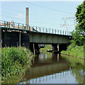
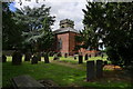
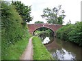
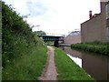
99 photos from this area
Area Information
Key information about the WS15 4DR including its size, population, and administrative classification.
- Area Type
- Postcode
- Area Size
- 1.4 hectares
- Population
- 1575
- Population Density
- 1481 people/km²
House Prices in WS15 4DR
16
Properties
£157,367
Average Sold Price
£76,000
Lowest Price
£418,000
Highest Price
Showing 16 properties
| Address | Type | Beds | Baths | Last Sale Price | Last Sale Date | |
|---|---|---|---|---|---|---|
| 4 Old Road, Handsacre, Rugeley, WS15 4DR | house | - | - | £125,000 | Jan 2023 | |
| 12 Old Road, Handsacre, Rugeley, WS15 4DR | Detached | 4 | 2 | £418,000 | Jan 2023 | |
| 10 Old Road, Handsacre, Rugeley, WS15 4DR | Terraced | 4 | 1 | £120,000 | Oct 2017 | |
| 6 Old Road, Handsacre, Rugeley, WS15 4DR | Terraced | 4 | 1 | £124,950 | Oct 2013 | |
| 14 Old Road, Handsacre, Rugeley, WS15 4DR | Detached | 6 | - | £240,000 | Nov 2012 | |
| 8 Old Road, Handsacre, Rugeley, WS15 4DR | Terraced | - | - | £120,000 | Jul 2006 | |
| 2 Old Road, Handsacre, Rugeley, WS15 4DR | Terraced | - | - | £119,500 | Dec 2005 | |
| 40 Old Road, Handsacre, Rugeley, WS15 4DR | house | 4 | - | £180,000 | Feb 2004 | |
| 26 Old Road, Handsacre, Rugeley, WS15 4DR | house | - | - | £129,950 | Aug 2001 | |
| 42 Old Road, Handsacre, Rugeley, WS15 4DR | Detached | 4 | 2 | £155,000 | Jan 2000 |
Page 1 of 2
Energy Efficiency in WS15 4DR
Amenities
Schools
| Rank | School | Type | Entry gender | Ages |
|---|
Explore more schools in this area
Go to Schools tabDemographics
Household Size
Two person
most common
Accommodation Type
Houses
most common
Tenure
72
majority
Ethnic Group
White
most common
Religion
N/A
most common
Household Composition
N/A
most common
Age
47
median
Adults (30-64 years)
most common
Household Deprivation
N/A
with no deprivation
NS-SEC
28
in Lower managerial occupations
Explore more demographic insights in this area
Go to Demographics tabPlanning
Planning Constraints
- Flood RiskPremium
- Ramsar Wetland SitesPremium
- Area of Outstanding Natural BeautyPremium
- Protected Nature ReservePremium
- Protected WoodlandPremium