Area Overview for WS15 4BW
Photos of WS15 4BW

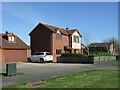
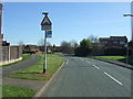
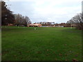
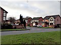
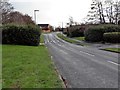
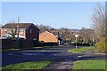
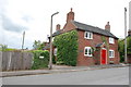
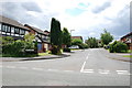
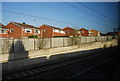

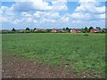
13 photos from this area
Area Information
Key information about the WS15 4BW including its size, population, and administrative classification.
- Area Type
- Postcode
- Area Size
- 1.2 hectares
- Population
- 1542
- Population Density
- 806 people/km²
House Prices in WS15 4BW
17
Properties
£274,700
Average Sold Price
£170,000
Lowest Price
£395,000
Highest Price
Showing 17 properties
| Address | Type | Beds | Baths | Last Sale Price | Last Sale Date | |
|---|---|---|---|---|---|---|
| 11 Hood Lane, Armitage, Rugeley, WS15 4BW | Detached | 4 | 2 | £294,000 | Sep 2025 | |
| 1D Hood Lane, Armitage, Rugeley, WS15 4BW | house | - | - | £345,000 | Jun 2025 | |
| 9 Hood Lane, Armitage, Rugeley, WS15 4BW | Retail | 4 | 1 | £285,000 | Mar 2022 | |
| 8 Hood Lane, Armitage, Rugeley, WS15 4BW | Bungalow | 2 | 2 | £395,000 | Jun 2021 | |
| Robin Cottage, 1B Hood Lane, Armitage, Rugeley, WS15 4BW | Semi-detached | 4 | 1 | £198,000 | Dec 2018 | |
| 2A Hood Lane, Armitage, Rugeley, WS15 4BW | Semi-detached | 3 | 1 | £170,000 | Nov 2017 | |
| 1C Hood Lane, Armitage, Rugeley, WS15 4BW | Semi-detached | 3 | 1 | £350,000 | Mar 2017 | |
| Casa Berytch, Hood Lane, Armitage, Rugeley, WS15 4BW | Bungalow | 3 | 2 | £255,000 | Aug 2015 | |
| 3 Hood Lane, Armitage, Rugeley, WS15 4BW | Detached | 3 | 2 | £280,000 | Jan 2014 | |
| The Hollies, 7 Hood Lane, Armitage, Rugeley, WS15 4BW | Detached | 3 | - | £175,000 | Jun 2000 |
Page 1 of 2
Energy Efficiency in WS15 4BW
Amenities
Schools
| Rank | School | Type | Entry gender | Ages |
|---|
Explore more schools in this area
Go to Schools tabDemographics
Household Size
Two person
most common
Accommodation Type
Houses
most common
Tenure
74
majority
Ethnic Group
White
most common
Religion
N/A
most common
Household Composition
N/A
most common
Age
47
median
Adults (30-64 years)
most common
Household Deprivation
N/A
with no deprivation
NS-SEC
30
in Lower managerial occupations
Explore more demographic insights in this area
Go to Demographics tabPlanning
Planning Constraints
- Flood RiskPremium
- Ramsar Wetland SitesPremium
- Area of Outstanding Natural BeautyPremium
- Protected Nature ReservePremium
- Protected WoodlandPremium