Area Overview for WS15 2XQ
Photos of WS15 2XQ
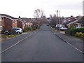
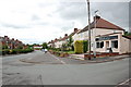
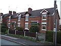
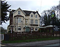
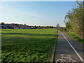
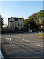
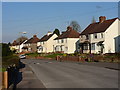
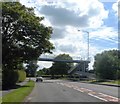
9 photos from this area
Area Information
Key information about the WS15 2XQ including its size, population, and administrative classification.
- Area Type
- Postcode
- Area Size
- 6143 m²
- Population
- 1203
- Population Density
- 6801 people/km²
House Prices in WS15 2XQ
13
Properties
£162,375
Average Sold Price
£63,500
Lowest Price
£280,000
Highest Price
Showing 13 properties
| Address | Type | Beds | Baths | Last Sale Price | Last Sale Date | |
|---|---|---|---|---|---|---|
| 3 Dayton Drive, Etchinghill, Rugeley, WS15 2XQ | Bungalow | 2 | 2 | £280,000 | Nov 2023 | |
| 2 Dayton Drive, Etchinghill, Rugeley, WS15 2XQ | Retail | 3 | 1 | £227,500 | May 2022 | |
| 9 Dayton Drive, Etchinghill, Rugeley, WS15 2XQ | Semi-detached | - | - | £158,000 | Sep 2016 | |
| 4 Dayton Drive, Etchinghill, Rugeley, WS15 2XQ | Bungalow | - | - | £170,000 | Apr 2016 | |
| 7 Dayton Drive, Etchinghill, Rugeley, WS15 2XQ | Bungalow | - | - | £125,000 | Jun 2014 | |
| 6 Dayton Drive, Etchinghill, Rugeley, WS15 2XQ | Bungalow | - | - | £154,000 | Apr 2006 | |
| 13 Dayton Drive, Etchinghill, Rugeley, WS15 2XQ | Semi-detached | - | - | £121,000 | Jan 2004 | |
| 5 Dayton Drive, Etchinghill, Rugeley, WS15 2XQ | Bungalow | - | - | £63,500 | Sep 1999 | |
| 11 Dayton Drive, Etchinghill, Rugeley, WS15 2XQ | Terraced | - | - | - | - | |
| 15 Dayton Drive, Etchinghill, Rugeley, WS15 2XQ | Terraced | - | - | - | - |
Page 1 of 2
Energy Efficiency in WS15 2XQ
Amenities
Schools
| Rank | School | Type | Entry gender | Ages |
|---|
Explore more schools in this area
Go to Schools tabDemographics
Household Size
Two person
most common
Accommodation Type
Houses
most common
Tenure
82
majority
Ethnic Group
White
most common
Religion
N/A
most common
Household Composition
N/A
most common
Age
47
median
Adults (30-64 years)
most common
Household Deprivation
N/A
with no deprivation
NS-SEC
26
in Lower managerial occupations
Explore more demographic insights in this area
Go to Demographics tabPlanning
Planning Constraints
- Flood RiskPremium
- Ramsar Wetland SitesPremium
- Area of Outstanding Natural BeautyPremium
- Protected Nature ReservePremium
- Protected WoodlandPremium