Area Overview for WS15 2UT
Photos of WS15 2UT
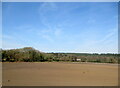
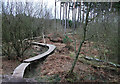
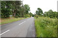
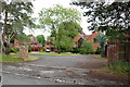
19 photos from this area
Area Information
Key information about the WS15 2UT including its size, population, and administrative classification.
- Area Type
- Postcode
- Area Size
- 36.5 hectares
- Population
- 1372
- Population Density
- 87 people/km²
House Prices in WS15 2UT
7
Properties
£147,714
Average Sold Price
£80,000
Lowest Price
£235,000
Highest Price
Showing 7 properties
| Address | Type | Beds | Baths | Last Sale Price | Last Sale Date | |
|---|---|---|---|---|---|---|
| 2, Forge Row, Slitting Mill Road, Slitting Mill, Rugeley, WS15 2UT | house | - | - | £235,000 | Feb 2022 | |
| 5, Forge Row, Slitting Mill Road, Slitting Mill, Rugeley, WS15 2UT | house | 3 | - | £170,000 | Apr 2013 | |
| 6, Forge Row, Slitting Mill Road, Slitting Mill, Rugeley, WS15 2UT | house | 2 | - | £142,000 | Aug 2012 | |
| 3, Forge Row, Slitting Mill Road, Slitting Mill, Rugeley, WS15 2UT | house | - | - | £105,000 | Aug 2011 | |
| 1, Forge Row, Slitting Mill Road, Slitting Mill, Rugeley, WS15 2UT | Terraced | - | - | £150,000 | Aug 2008 | |
| 7, Forge Row, Slitting Mill Road, Slitting Mill, Rugeley, WS15 2UT | Terraced | - | - | £152,000 | Feb 2004 | |
| 4, Forge Row, Slitting Mill Road, Slitting Mill, Rugeley, WS15 2UT | Cottage | 3 | 2 | £80,000 | Nov 1998 |
Energy Efficiency in WS15 2UT
Amenities
Schools
| Rank | School | Type | Entry gender | Ages |
|---|
Explore more schools in this area
Go to Schools tabDemographics
Household Size
Two person
most common
Accommodation Type
Houses
most common
Tenure
93
majority
Ethnic Group
White
most common
Religion
N/A
most common
Household Composition
N/A
most common
Age
47
median
Adults (30-64 years)
most common
Household Deprivation
N/A
with no deprivation
NS-SEC
38
in Lower managerial occupations
Explore more demographic insights in this area
Go to Demographics tabPlanning
Planning Constraints
- Flood RiskPremium
- Ramsar Wetland SitesPremium
- Area of Outstanding Natural BeautyPremium
- Protected Nature ReservePremium
- Protected WoodlandPremium