Area Overview for WS15 2NX
Photos of WS15 2NX
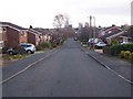
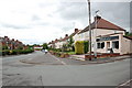
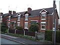
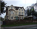
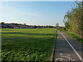
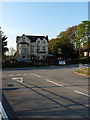
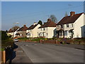
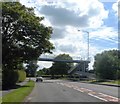
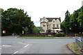
9 photos from this area
Area Information
Key information about the WS15 2NX including its size, population, and administrative classification.
- Area Type
- Postcode
- Area Size
- 1.1 hectares
- Population
- 1203
- Population Density
- 6801 people/km²
House Prices in WS15 2NX
31
Properties
£107,569
Average Sold Price
£12,950
Lowest Price
£225,000
Highest Price
Showing 31 properties
| Address | Type | Beds | Baths | Last Sale Price | Last Sale Date | |
|---|---|---|---|---|---|---|
| 14 Upfield Way, Etchinghill, Rugeley, WS15 2NX | Detached | 3 | 1 | £225,000 | Mar 2025 | |
| 22 Upfield Way, Etchinghill, Rugeley, WS15 2NX | Semi-detached | - | - | £12,950 | Mar 2024 | |
| 27 Upfield Way, Etchinghill, Rugeley, WS15 2NX | house | 3 | - | £207,000 | Aug 2022 | |
| 16 Upfield Way, Etchinghill, Rugeley, WS15 2NX | Semi-detached | 4 | 1 | £192,000 | Oct 2020 | |
| 4 Upfield Way, Etchinghill, Rugeley, WS15 2NX | Semi-detached | 3 | 1 | £162,500 | Jun 2020 | |
| 29 Upfield Way, Etchinghill, Rugeley, WS15 2NX | Semi-detached | 3 | 1 | £144,000 | May 2019 | |
| 26 Upfield Way, Etchinghill, Rugeley, WS15 2NX | house | - | - | £160,000 | Nov 2018 | |
| 10 Upfield Way, Etchinghill, Rugeley, WS15 2NX | house | - | - | £157,500 | Jul 2018 | |
| 24 Upfield Way, Etchinghill, Rugeley, WS15 2NX | house | - | - | £119,000 | Aug 2014 | |
| 6 Upfield Way, Etchinghill, Rugeley, WS15 2NX | Semi-detached | - | - | £145,000 | Nov 2007 |
Page 1 of 4
Energy Efficiency in WS15 2NX
Amenities
Schools
| Rank | School | Type | Entry gender | Ages |
|---|
Explore more schools in this area
Go to Schools tabDemographics
Household Size
Two person
most common
Accommodation Type
Houses
most common
Tenure
82
majority
Ethnic Group
White
most common
Religion
N/A
most common
Household Composition
N/A
most common
Age
47
median
Adults (30-64 years)
most common
Household Deprivation
N/A
with no deprivation
NS-SEC
26
in Lower managerial occupations
Explore more demographic insights in this area
Go to Demographics tabPlanning
Planning Constraints
- Flood RiskPremium
- Ramsar Wetland SitesPremium
- Area of Outstanding Natural BeautyPremium
- Protected Nature ReservePremium
- Protected WoodlandPremium