Area Overview for WS15 2HH
Photos of WS15 2HH

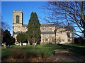
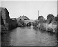
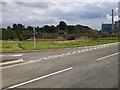
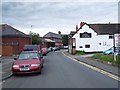
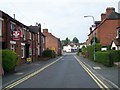

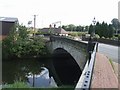

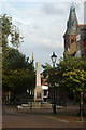
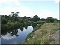

100 photos from this area
Area Information
Key information about the WS15 2HH including its size, population, and administrative classification.
- Area Type
- Postcode
- Area Size
- 1.1 hectares
- Population
- 1660
- Population Density
- 2346 people/km²
House Prices in WS15 2HH
26
Properties
£177,944
Average Sold Price
£98,500
Lowest Price
£340,000
Highest Price
Showing 26 properties
| Address | Type | Beds | Baths | Last Sale Price | Last Sale Date | |
|---|---|---|---|---|---|---|
| 13 Millington Street, Rugeley, WS15 2HH | house | - | - | £340,000 | Mar 2025 | |
| 21 Millington Street, Rugeley, WS15 2HH | Detached | 4 | 1 | £225,000 | May 2021 | |
| 12 Millington Street, Rugeley, WS15 2HH | Semi-detached | 2 | - | £170,000 | Apr 2021 | |
| 14 Millington Street, Rugeley, WS15 2HH | Detached | 4 | - | £235,000 | Jan 2014 | |
| 8 Millington Street, Rugeley, WS15 2HH | Terraced | - | - | £125,000 | Jan 2008 | |
| 22 Millington Street, Rugeley, WS15 2HH | house | - | - | £200,000 | Jun 2004 | |
| 16 Millington Street, Rugeley, WS15 2HH | Detached | - | - | £98,500 | May 2001 | |
| 17 Millington Street, Rugeley, WS15 2HH | Detached | - | - | £105,000 | Jun 1999 | |
| 25 Millington Street, Rugeley, WS15 2HH | Detached | - | - | £103,000 | Nov 1998 | |
| 11 Millington Street, Rugeley, WS15 2HH | Terraced | 4 | 1 | - | - |
Page 1 of 3
Energy Efficiency in WS15 2HH
Amenities
Schools
| Rank | School | Type | Entry gender | Ages |
|---|
Explore more schools in this area
Go to Schools tabDemographics
Household Size
One person
most common
Accommodation Type
Houses
most common
Tenure
40
majority
Ethnic Group
White
most common
Religion
N/A
most common
Household Composition
N/A
most common
Age
47
median
Adults (30-64 years)
most common
Household Deprivation
N/A
with no deprivation
NS-SEC
22
in Lower managerial occupations
Explore more demographic insights in this area
Go to Demographics tabPlanning
Planning Constraints
- Flood RiskPremium
- Ramsar Wetland SitesPremium
- Area of Outstanding Natural BeautyPremium
- Protected Nature ReservePremium
- Protected WoodlandPremium